
The Aotea Track is a 27km circuit around the centre of Great Barrier Island, including it’s highest point, the 627m high Mt Hobson. Very doable in weekend, only a 30 minute flight from Auckland, but a world away in terms of the number of people and civilisation.
 Great Barrier Island at one time was part of the Coromandel Peninsula until the sea levels rose, so has a very similar landscape but is far less developed, with only 900 people living on an island nearly the size of Auckland. Over Christmas and New Year it gets particularly busy but even at the end of November it was super quiet, with just three fellow passengers on the flight out, three others in a hut built for 20 people, and I saw only one person during nearly five hours walking the track.
Getting there is an adventure in itself, flying in an eight seater aircraft, often with scenic views as you past over the city and islands in the Hauraki Gulf. Unfortunately I spent most of the trip out dazzled by brilliant white cloud and deafened by the engines, though this was still probably better than four hours on a ferry. The final descent into the grass runway at Claris through thick cloud with a few bumps wasn’t for the faint hearted though.

 Go Great Barrier Island looked after me, collecting me from the airport and dropping me near the Green Campsite to start the track. Unfortunately this coincided with light rain which turned to heavy rain leaving my drenched through. It wasn’t cold though so I didn’t really mind, good motivator to keep going and I always carry a complete change of dry clothes with me on multi day tramps.
 The one thing that did suffer because of the rain was access to my track map, which was kept safe and dry in my pack. This turned out to be a mixed blessing.
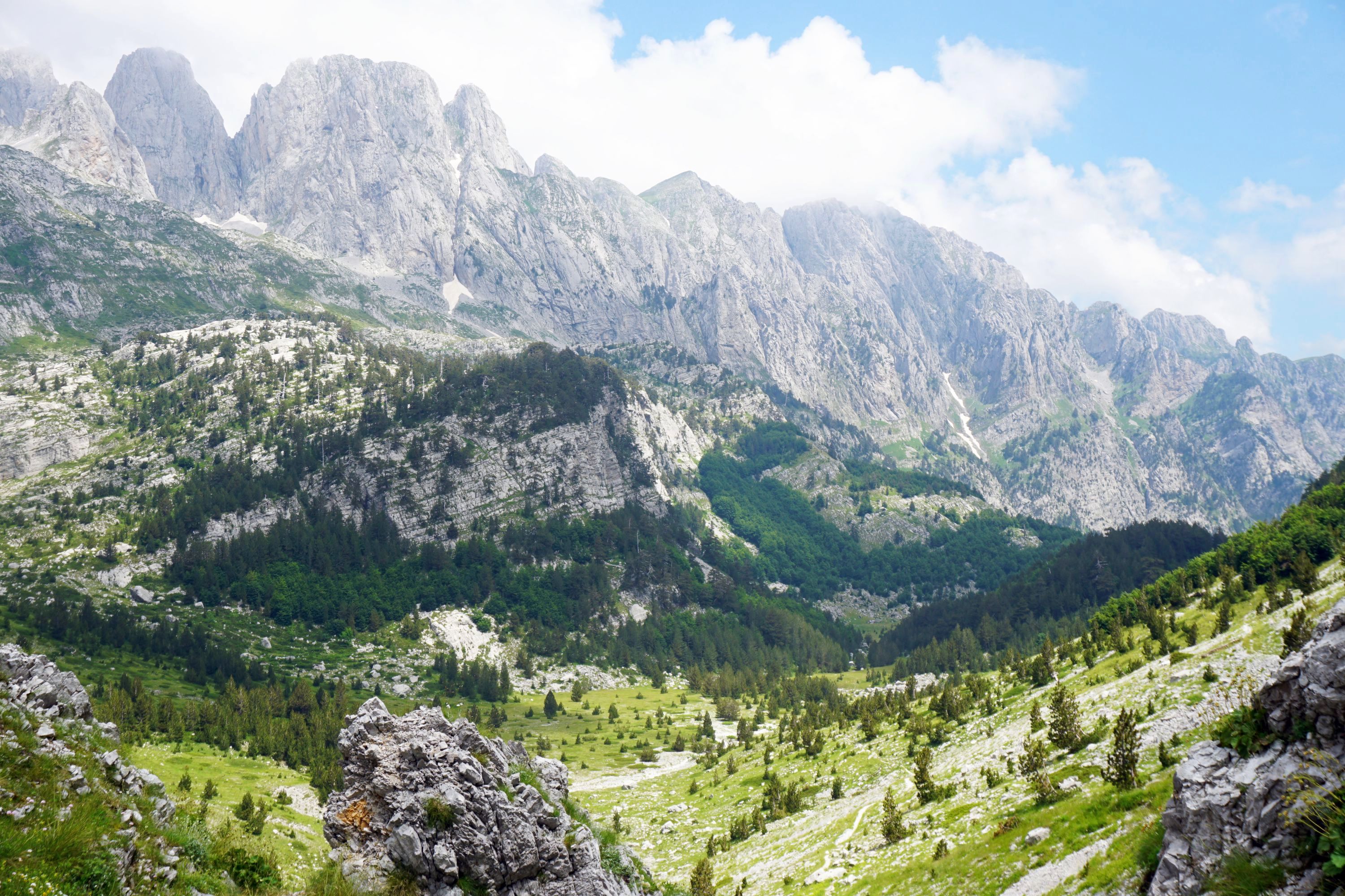
Headed along some very well maintained tracks, mostly up to Great Walk standard, with plenty of steps and bridges. The bush was vibrant green from the rain, though there wasn’t much else to see other than the small Kauri Waterfall near the start, until I got onto the Peach Tree Track, which climbed about 500m with the reward of views behind toward Claris and the coast.


 My destination for day one had been Mt Heale Hut, but I arrived there somewhat sooner than expected, having completely missed my planned stop at Kaiaraara Hut by accidentally going anti clockwise instead of the intended clockwise direction around the circuit. Consulting the map may have been useful after all…
 However speaking to others in the hut the stretch from Green Campsite to Kaiaraara Hut is a bit of a slog along Forest Road, a dirt road rather than a track, which I followed briefly and was relieved in retrospect to have missed. The Kaiaraara Track from the hut to Mt Beale Hut has been closed since epic storms in June 2014, along with the Old Kauri Dams I’d hoped to see but are no longer since the storms. Thankfully there is a similar length route between the huts via the South Fork Track but apparently there isn’t a huge amount to see from the track.
Mt Heale Hut is one of the better huts I’ve stayed in, with two bunk rooms and a sizeable living area complete with gas cookers (didn’t even need matches), lights, occasional 3G signal, and even saucepans and frying pans (never seen before in a hut), plus stunning views toward Little Barrier Island, or views of cloud, depending on the weather. No stove though so glad I brought some layers of merino.

 There were only four of us in the hut, a pair of New Zealand ladies, one of whom turned out to be the neighbour of a friend of mine (very New Zealand), and a German traveller, a very common sight in huts, but they don’t usually bring their guitar with them tramping.
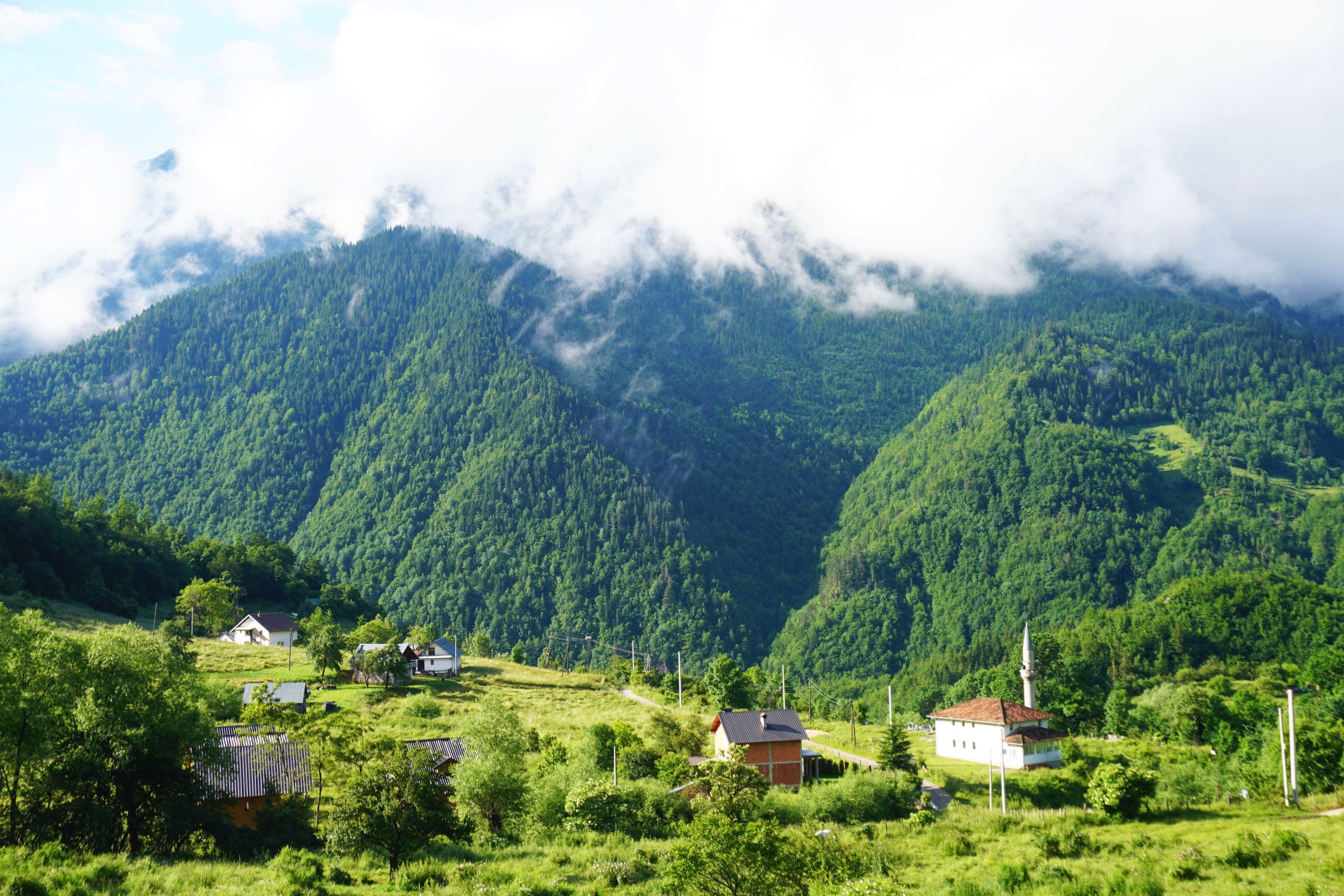
Plenty of birdsong in the evening, much more than I found on Stewart Island, despite it’s reputation. In the morning I managed to catch the sun rising behind the hut, and hitting the valleys heading away from the hut, before the cloud returned.


 Rather than retracing most of my steps I changed my plans to leave by the Palmers Track to Windy Canyon, taking me up Mt Hobson. Luckily got there in time to see this…


 As twenty minutes later it looked like this…
 It cleared as I descended the Palmers Track which was probably the most scenic part of the walk, despite it not being part of the official Aotea Track.
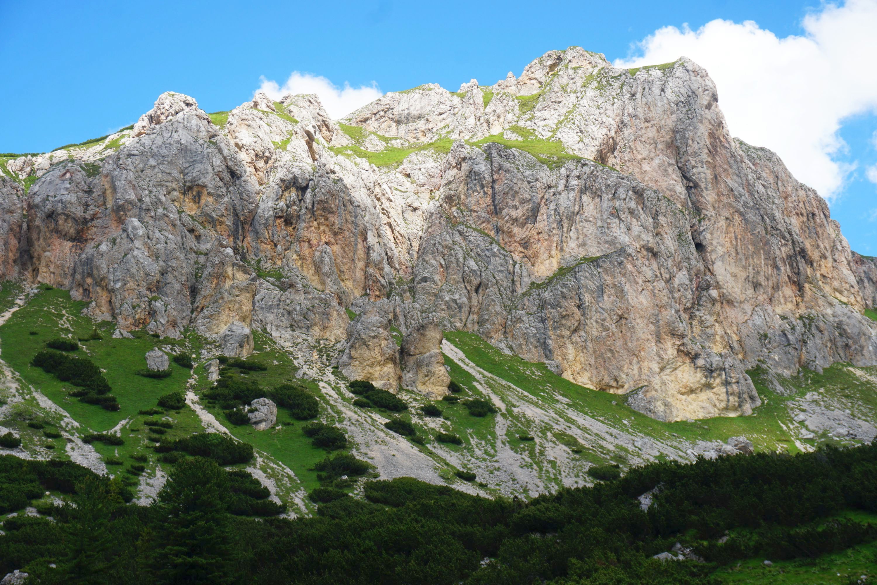
 Windy Canyon made for a pretty spectacular finish, with epic rock formations jutting out of the bush.

 Reflecting on the walk afterwards and feedback from others in the hut my recommendation would be to skip half of the official Aotea Track (Forest Road and South Fork Track) and instead do what I did in reverse, as it’ll be more downhill than uphill, and you’ll be walking toward to the views from the Peach Tree Track rather than having to stop to look behind you. Also instead of ending at the Green Campsite you could finish via the Kaitoke Hot Springs for a relaxing soak.
So to maximise the views, and minimise the walking and hills start at Windy Canyon on Aotea Road. A decent day walk (about 7 hours) would be to head along Palmers Track, up Mt Hobson and onto Mt Heale Hut for lunch before returning the way you came. The hut has views to savour as the sun sets and rises though, and there are great views from Peach Tree Track, so an overnight stay there and finish at Whangaparapara Road via the Kaitoke Hot Springs on would make for a near perfect weekend away from Auckland.
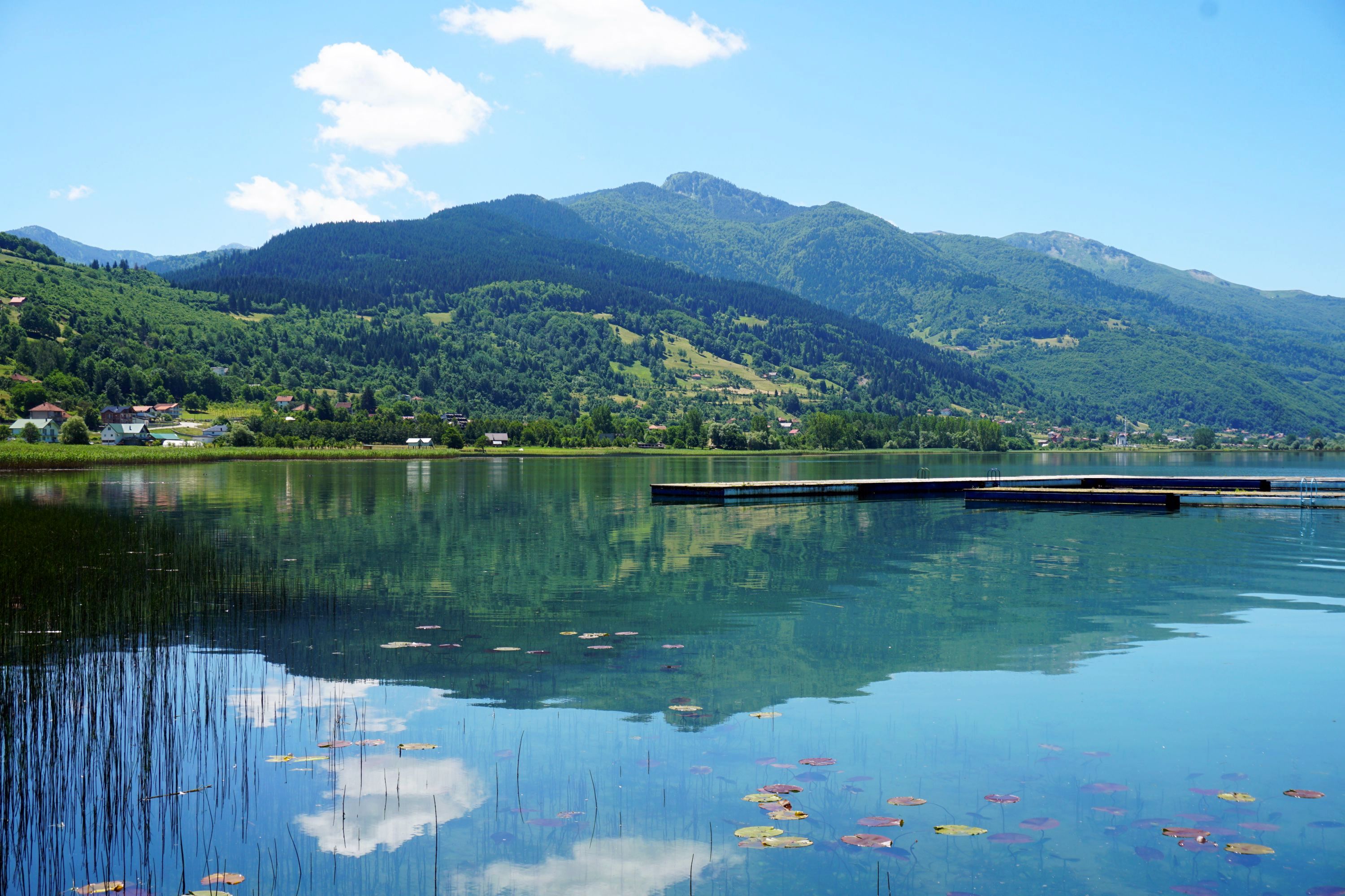
Btw the flight back was much better, got to see this beautiful place from the air.


Leave a Reply