Less than two hours drive from Christchurch, Mt Somers Track is a scenically varied and reasonably challenging 28.7km (including the summit) weekend tramp / hike on the edge of the Southern Alps. I was lucky with glorious weather for the first days of summer, though over 30C was a little on the hot side when you’re carrying a 15kg pack and ascending / descending more than 1,500m.
I flew down Friday evening from Auckland, and spent the night in sleepy Methven. From here it was less than half an hour to Sharplin Falls Car Park to start the track. Despite the weather and proximity to Christchurch I saw almost no one on the track all weekend, other than a few on the summit track and at the huts.
From the car park it was pretty much straight up the mountainside for the next two and a half hours to reach the summit of Mt Somers, ascending well over 1,200m. Thankfully I could drop my overnight pack half way at the junction, and carry a small daypack for the steepest section. I was soon out of the bush line and enjoying the views.


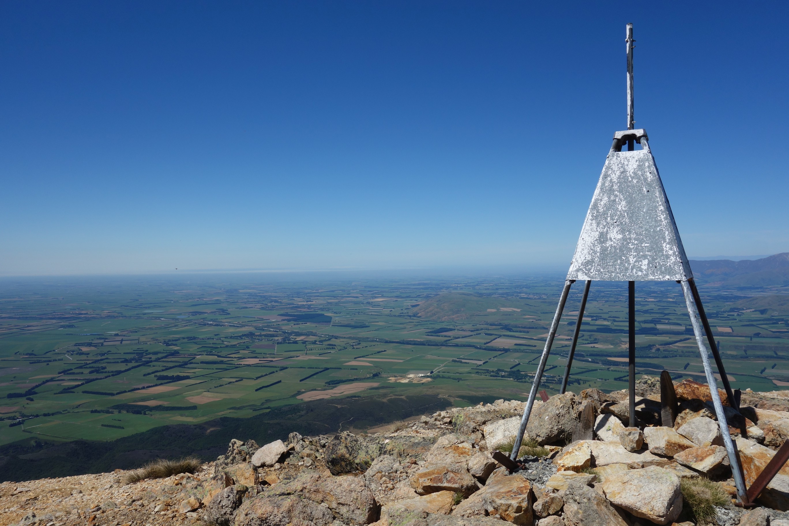
As well as the usual triangular trig the summit had an unusual cairn surrounded by wooden railings saying “Revere yesterday, build on today, absorb energy and inspiration from this place”.

The 1,687m summit also had the views you’d expect, to the east over the endless expanse of the Canterbury plains, prime diary country made clear by every other vehicle on the road being a Fonterra milk tanker, and to the west the Southern Alps, some snow capped on the first day of summer.

I made my way carefully back down to collect my overnight pack and continued along the track to the Rhyolite Ridge Track junction. Forest soon turned to more open landscape with views of the plains, and I briefly stopped at the Acland Shelter, where thankfully nearby there was a stream to refill my empty water bottles.

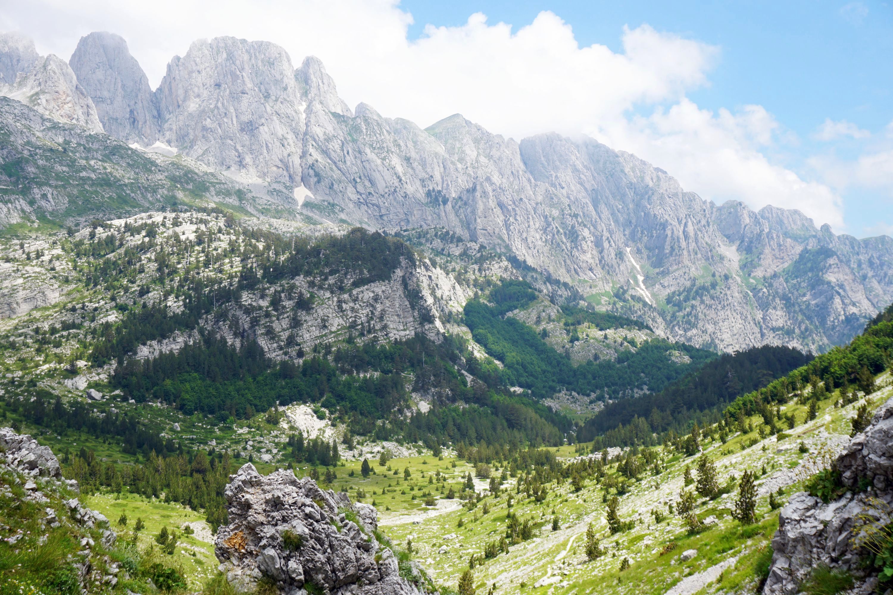
My original plan was to head down the Rhyolite Ridge Track to the Woolshed Creek car park and up the Miners Track, a four hour walk. Given my flagging energy by this point, it had been nearly nine months since I last did an overnight tramp / hike, continuing on the Mt Somers Track for another two hours was more appealing. As was the scenery it seemed with this section being my highlight of the weekend, starting with tussock in the foreground and mountains in the distance.
This rather wonderful rock outcropping was oddly called the Bus Stop.


Further along a sign saying waterfall 5 mins should never be ignored.

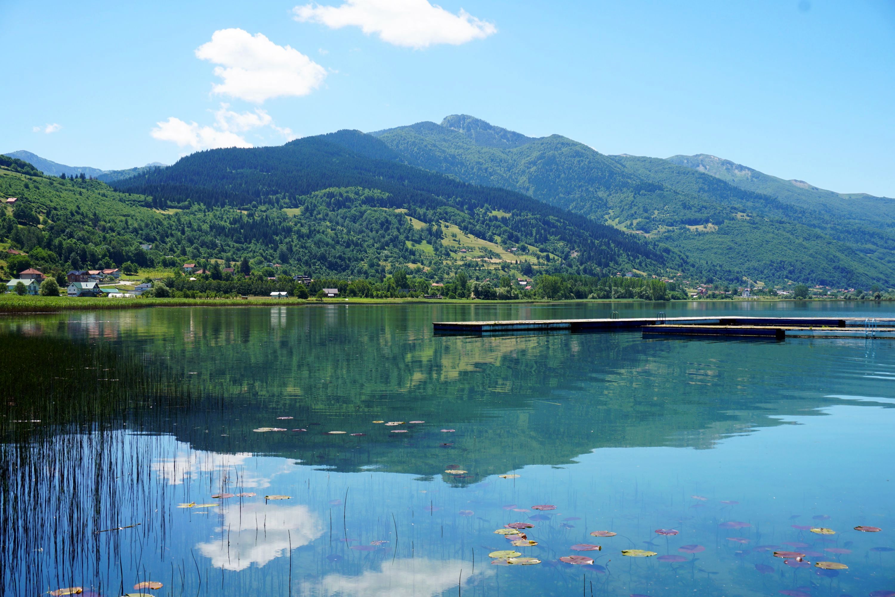
The hut was visible well before arriving, nestled in some spectacular scenery, with an epic swing bridge to cross.


There has been a Woolshed Creek Hut here since the late 1800s, but the current one dates from 2005. It’s as you’d expect a modern hut to be, well designed and accomodating. I’m a big fan of huts but given the weather thought I’d use my tent for the first time in New Zealand (have used it in Australia).


I wandered up a couple of the nearby ridges to catch the light of the setting sun on the landscape before turning in for the night.

It was surprisingly cold overnight but soon warmed up, getting hot from half seven onwards, though the continuous ascent up the valley might have contributed. Again hard to ignore a sign that says Water Caves 5 mins, and they were a little treat to start the day, with huge stacked boulders and flowing waters, a wonderful and unexpected spot.

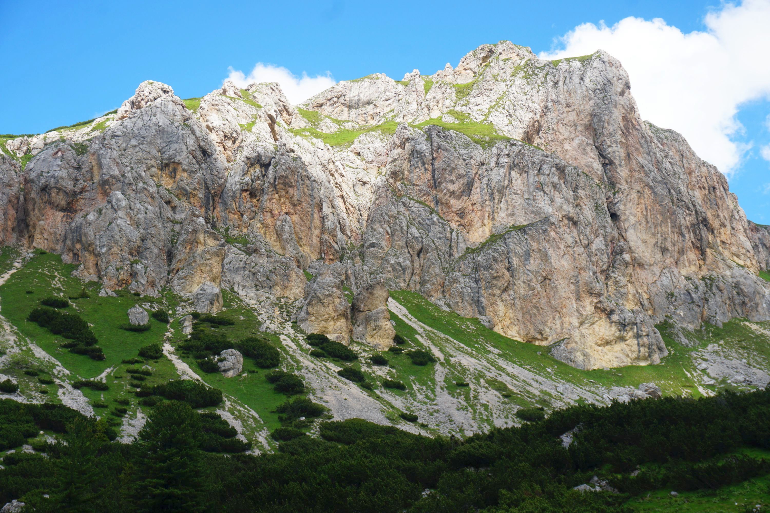
Heading up the valley rewarded with more epic views, before heading downhill to Pinnacles Hut where I met a couple of climbers off to tackle said Pinnacles. The mountainside was covered with huge rock formations, clearly formed by volcanic activity, and very similar to those I saw on the South Coast of Iceland.


The hut made the perfect spot for an early lunch sitting on the deck.
The final section back to Sharplin Falls car park was the least enjoyable of the trip, with an almost continuous descent testing the knees (and semi-abseil skills with a couple of sections with chains), and almost no views as through bush the whole way. There were a couple of rather lovely waterfalls though, particularly this one the track went behind.

Was treated to one final view of Mt Somer before returning to the car park and back to civilisation. Perfect way to spend a day and a half, great exercise for 12 hours, wonderful views, and near absolute peace and solitude.

Leave a Reply