Days seven and eight walking in the Rwenzori Mountains in west Uganda, the former being the shortest and easiest of the trip, and the later the second most terrifying and exhausting of the trip.
At Margarita Camp there were a few nice views before heading back down to Hunwick’s Camp. It was the shortest day of the trip, just over two hours, welcome after the eleven hour marathon the previous day summiting Margarita Peak. I’ve not slept for twelve hours for a very long time but needed it after the 1am start and exertions of the previous day.

Although I’d walked this section of track two days prior it was a pleasure to walk back along it the other way, with views down the valley, and morning sunshine (which rarely appears to last).


Behind us was Margarita Peak, the summit of Mt Stanley, where I’d stood about 24 hours before.

The mountainside looked particularly attractive lit up as I descended past these odd plants.


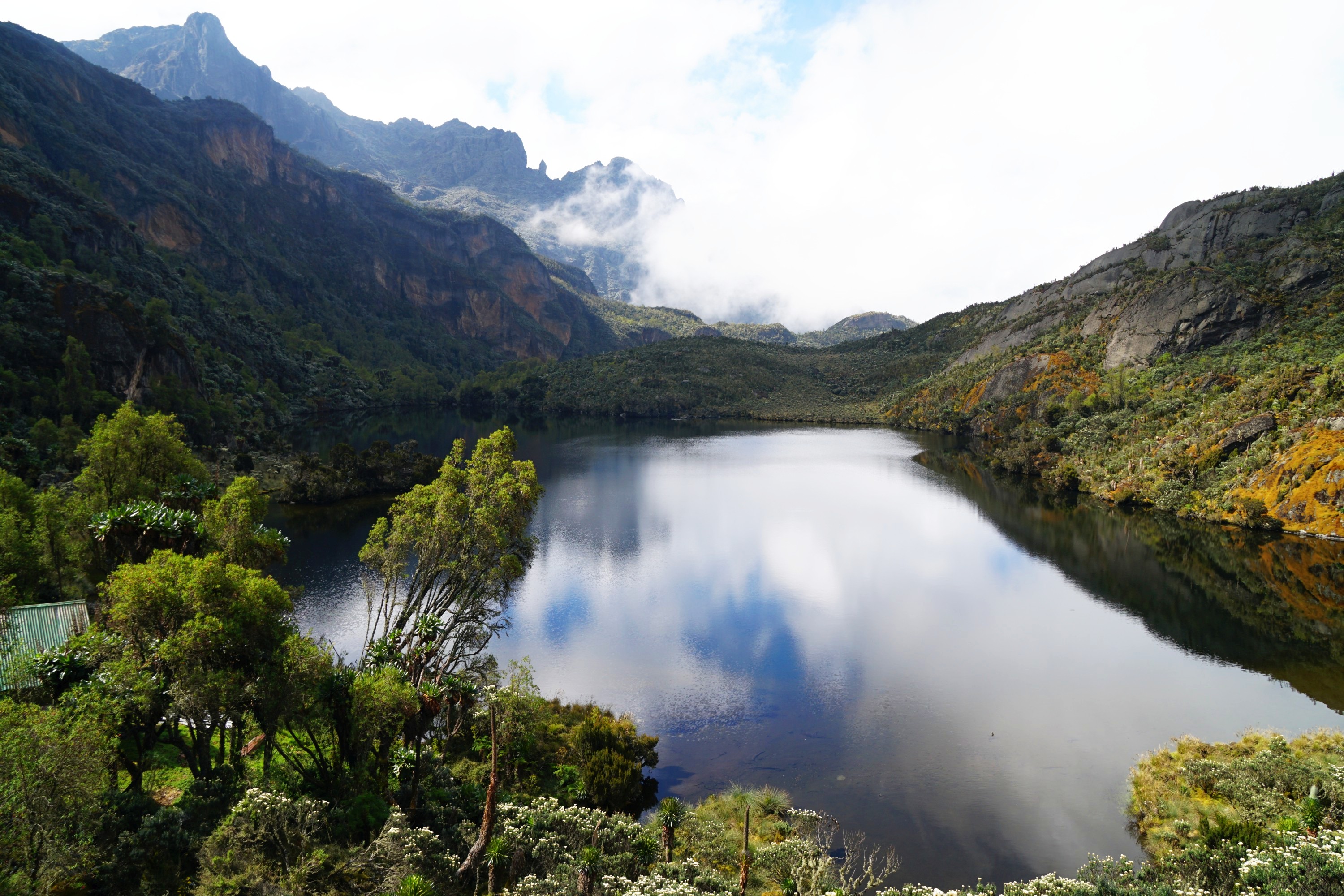
Kitandara Lakes were rather stunning below, both in sunshine and then mist.


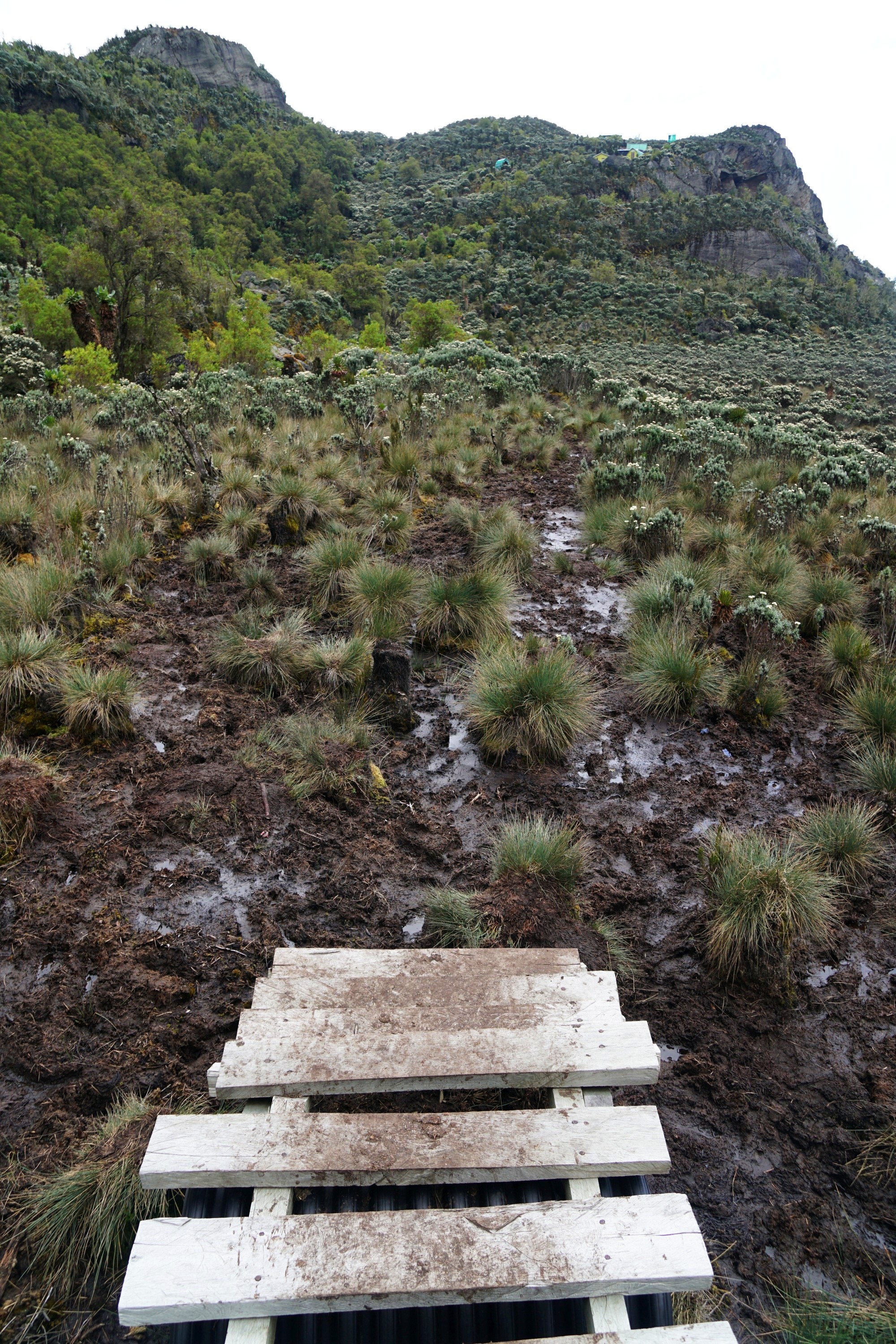
I rather enjoyed returning to thick mud and bog, much more enjoyable than descending the slippery rocks from Margarita Peak yesterday. Bogs have the mental challenge of working out the best route, figuring out from sight how thick the mud is, and the worst consequence is getting muddy. After crossing the bog there was a final steep but short climb back to Hunwick’s Camp for a quiet afternoon, cosy by a warm stove, avoiding the rain and thunder outside. One upside was the appearance of waterfalls down the mountainside reminding me of the Milford Track.


As usual though the skies cleared shortly before sunset, basking the landscape in a warm glow.


The following day took me back to Bugata Camp where I stayed on day three, but via a different and harder route via Oliver’s Pass and the summit of Mt Weismann. Leaving Hunwick’s Camp it was bathed in sunlight, which for the first time in the whole trip lasted for the majority of the day.


I love these Giant Lobelias, such surreal plants.


It was rapidly back to bog crossing, which is hard to photograph, but rest assured that between these tussocks is deep and liquid mud.


More unusual plants set against the landscape, unlike anywhere else that I’ve hiked.


The views improved as myself and my guide climbed muddy slopes.


The mud was replaced for a bit by rock and colourful moss.


Behind were views of the upper and lower Kitandara Lakes I’d passed yesterday.

The landscape was rock and moss when I crossed Oliver’s Pass at 4,505m.

Here I had to decide whether to take about an hour detour to the 4,620m summit of Mt Weismann. The weather was relatively clear so I decided it’d make a good spot for lunch and views.

In retrospect I’m not sure I would have made the same decision again. To reach the summit required scrambling / almost climbing damp, slippery, moss covered steep rocks in gumboots, which was quite terrifying. I love hiking but am not a fan of rock climbing, unless roped.


There were some pretty good views to partly compensate at least.

The summit was a sea of moss with views in the distance of the Democratic Republic of Congo, which shares the Rwenzori Mountains with Uganda.


From here there was a quite exhausting and nerve wracking steep descent down a boulder filled gully.


It was a relief to return to the mud though it looked like rather a lot of trees had been sacrificed here to prevent people from disappearing into it.

The landscape got even more surreal heading down, hard to take it all in.


In the distance were Lake Kopello and Lake Bugata. There were some good reflections walking past Lake Kopello, though trying to get a bit closer to the lake I nearly went into it, sinking into the boggy grass around the shoreline.


After six hours of walking it was a relief to reach Bugata Camp by mid afternoon.


Leave a Reply