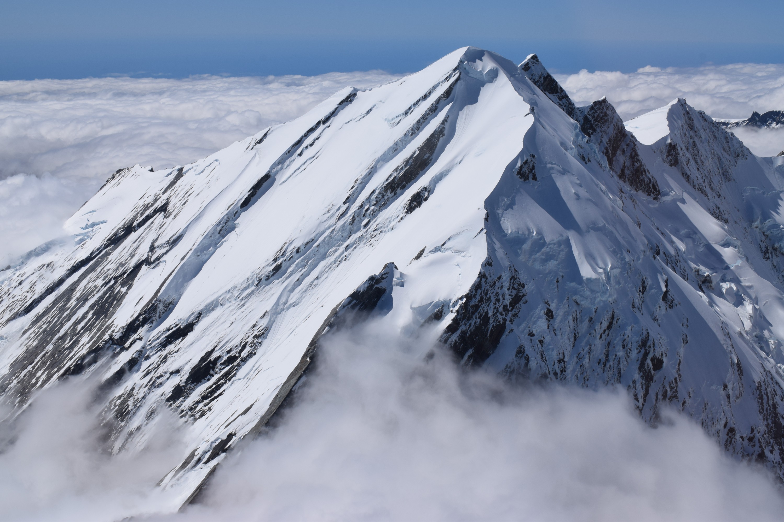
The best way to see the 3,754m high Mt Cook, New Zealand’s tallest mountain, is to fly past it. Which I’ve done rather a lot of times flying into Queenstown but never as close as on an hour long scenic flight from Franz Josef Glacier. Was very lucky with the weather, this was one of only five days they’d flown in January, down 60% on last year. There was a base of cloud covering the mountains up to The Divide but thankfully plenty to see above it and it had a few gaps to the glaciers below.
From the air it’s easier to grasp the hugeness of the glacier fed rivers and the amount of debris they carry.

There were also some rather lovely lakes and turquoise blue waters out to sea.


The clouds parted perfectly for a brief glimpse of a glacier below.

There were plenty more to come though, around 140 in this area, with surreal white sheets of snow and ice peppered with cracks.

We flew by Mt Cook, Mt Tasman and other assorted mountains.


 It was apparent when we crossed The Divide as the landscape changed completely, far less snow, with Mt Cook village and Lakes Hooker, Mueller and Tasman visible below.

A flash of blue caught my eye, somewhat out of place amongst all the rock and snow.

More glaciers and mountains as we headed back across The Divide and toward Franz Josef.


Leave a Reply