
The final couple of days of a ten day hike in Uganda’s Rwenzori Mountains, descending more than 2,400m from the alpine to the tropical.
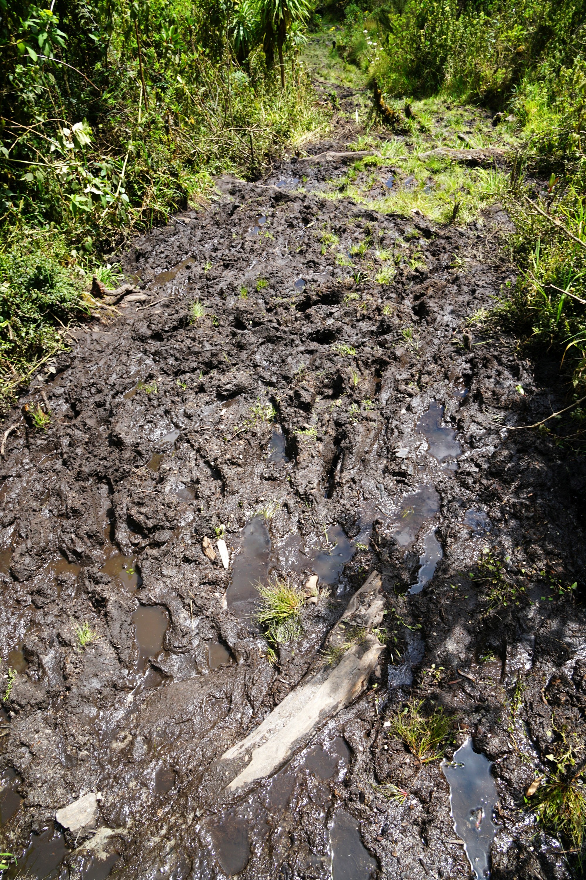
Incredibly the penultimate day was the muddiest of the whole trip, with probably 80% of the five and half hours hiking spent battling through thick mud in gumboots. It is one of the key features of the Rwenzori Mountains, and terrain I quite enjoyed tackling for the challenge.
Heading down from Bugata Camp the valley was filling with the first rays of sunlight.

It wasn’t long before tackling another bog, something I’ve had plenty of practice at over the past week and a half.

This section of boardwalk providing a little relief before ending and returning me to bog.


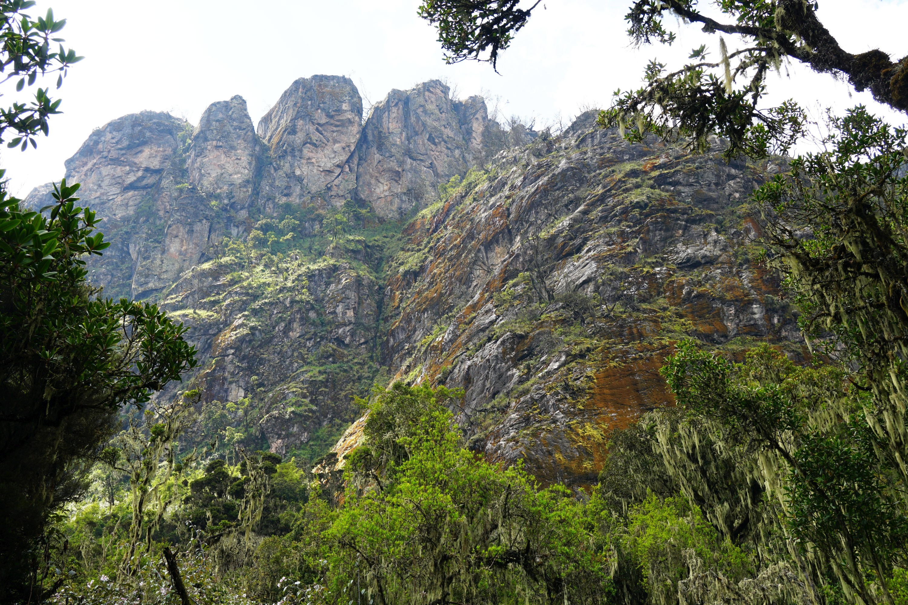
There were some unusually shaped mountains and lots of dead trees around.


After a couple of hours we walked through a gap in the mountains, providing a brief respite from the mud. It was replaced with a steep rocky path which I didn’t enjoy much other than the views. At some point around here we crossed Hunwick’s Pass which didn’t appear to be signposted.


The steepness of the path lessened and turned back to mud before reaching Kiharo Camp for lunch.


Nearby there was an attractive waterfall worth a quick explore.

After lunch the landscape was quite different, but the quantity of mud remained the same.


I saw a couple of Red Forest Duiker, deer like creatures, on the path ahead though they soon fled when we got closer.

There were so many yellow flowers around on this section, which I’d barely seen during the previous eight days.


After walking mostly on the flat or downhill for much of the day a 200m steep climb in the afternoon sunshine was a bit of a challenge.

There were some good views across the valley to compensate though.

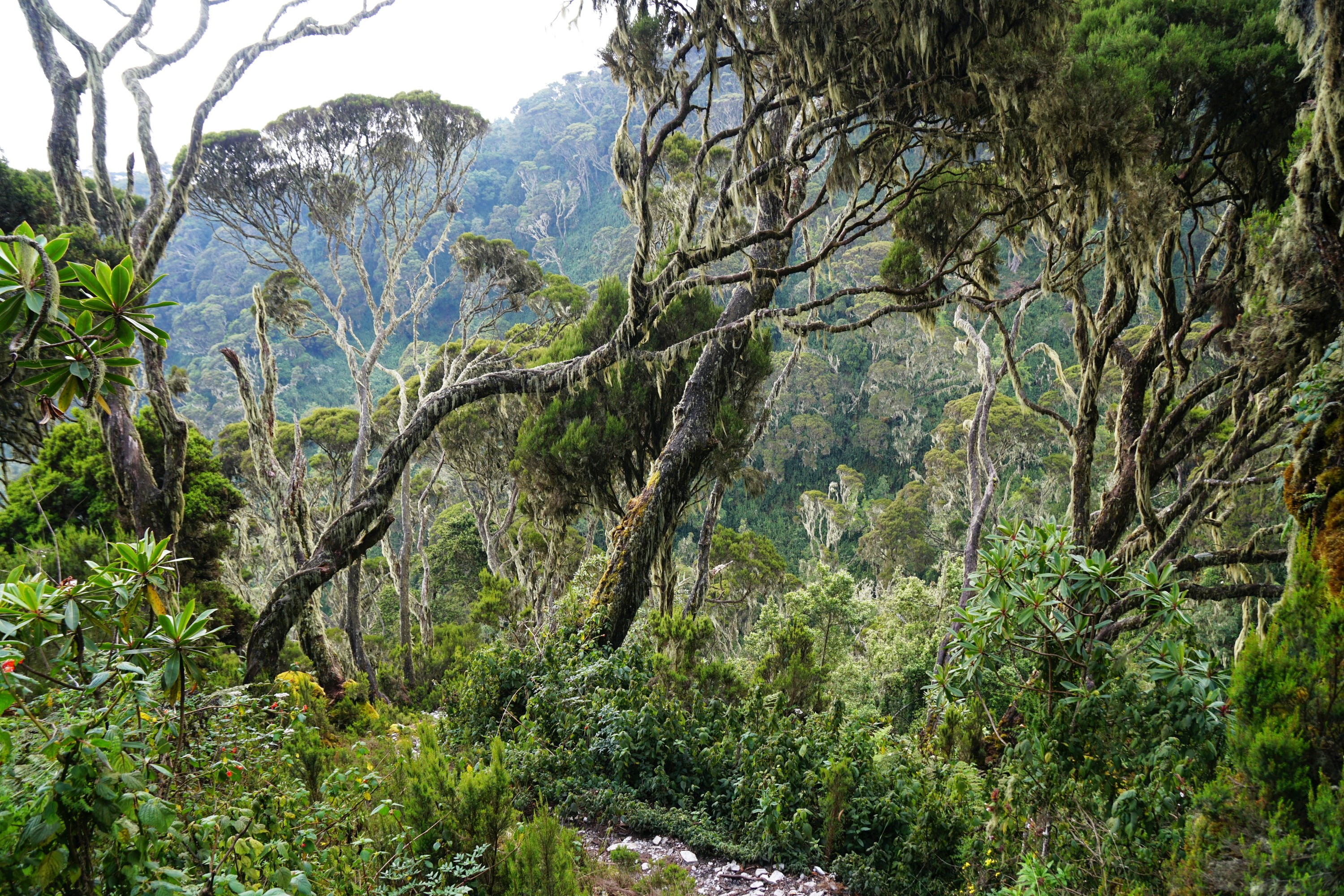
The landscape changed yet again, to something resembling Fjordland in New Zealand.
I reached Samalira Camp by mid afternoon. At 3,170m above sea level this was the lowest I’d been in more than a week, and it was noticeably easier to breath.


Sunrises in Uganda were quite unusual as I rarely saw the sun appear on the horizon. Instead it would appear a little way above cloaked in clouds before finally emerging.

The final day of hiking involved a rather brutal 1,500m descent in two and a half hours (at a pace that my porter couldn’t keep up with me). Thankfully it was mostly devoid of mud so for the first time in over a week (other than the day I summited Mt Stanley) so I could wear my hiking boots rather than gumboots.

Soon after leaving Samalira Camp I passed through the aptly named bamboo zone.

Which turned into more temperate forest.


With occasional views.

This swing bridge brought back memories as I’d walked past it ten days ago and the guide had said that we would be coming back over it at the end of the hike. It felt like both forever ago and like yesterday, time often feels non linear when travelling…

After leaving the national park there were expansive views down the valley, and tropical temperatures.


This tree covered in spider webs was unexpected.


It was a bit of a shock to return to a road and civilisation in the village of Kyanjuki, before saying thank you and good bye to the incredible crew from Rwenzori Trekking Services, and starting the long journey back to New Zealand…


Leave a Reply