One of New Zealand’s best known coastal walks, the Queen Charlotte Track runs for 71km between Queen Charlotte Sound and Kenepuru Sound at the top of the South Island. It’s a particularly scenic stretch of coastline but the track itself is quite mixed hiking as it’s dual use with mountain bikers for much of the year (other than Dec-Feb when they’re not allowed).
I walked the track in mid-November 2020, when despite the New Zealand border being closed due to Covid the track was busier than normal according to the water taxi company. Similarly bookings on the Great Walks were at record highs with locals making the most of New Zealand’s National Parks. It was before peak season though so other than a big group described later on there were only about a dozen people hiking and cycling the track.
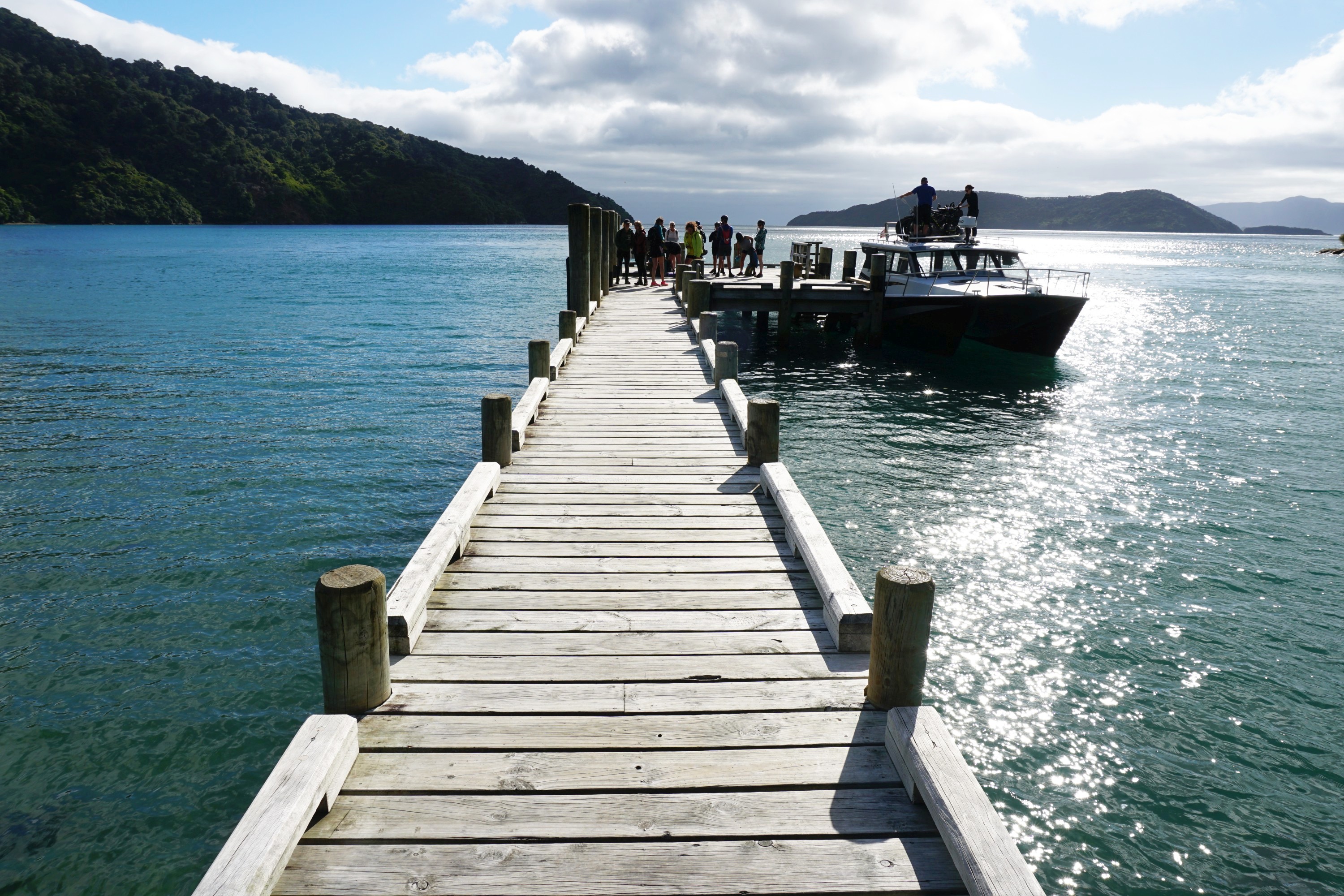
Picton Harbour was looking good at 7.30am when I checked in my main bag to be taken by water taxi to Punga Cove. I walked with a day pack, a real novelty from carrying everything myself, which is the normal situation in New Zealand.


The 50 minute water taxi ride to Ship Cove was as scenic as any journey by boat in this area. We overtook a BlueBridge ferry on its way to Wellington and saw dolphins in the distance.


Ship Cove is a beautiful spot, and it’s understandable why Captain Cook chose to spend 170 days over five stays here during his three epic voyages.


There’s a sizeable monument to him erected in 1912, paid for by public subscription.


From here it was uphill along a real gash of a track, which looks relatively newly cut. I’m really not a fan of dual use tracks, they’re often dull to walk along, and you have to watch out for bikes, though given the logistics of this track you tend to only see them twice a day, going in each direction. Apparently the track is roughly half walkers and half bikers outside of summer. eBikes are becoming increasingly popular, and would be well suited to the hills, particularly after Camp Bay.


After half an hour I reached Ship Cove Saddle with views of the Inner and Outer Queen Charlotte Sound.


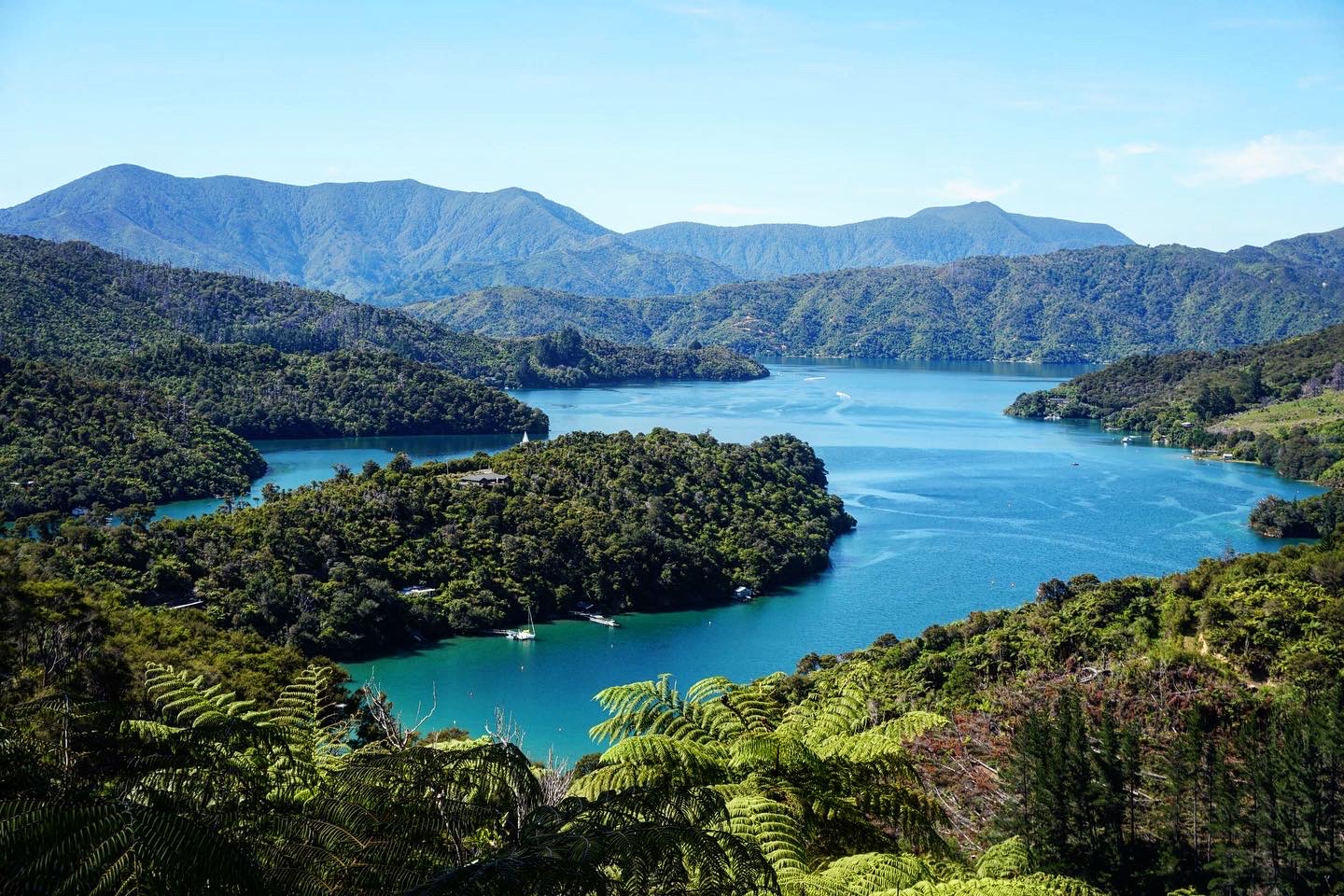
Heading back down to Schoolhouse Bay campsite gave me the first of many views of the stunningly coloured waters of the Sounds.


Across the bay was Resolution Bay Lodge, looking inviting but I’d decided to stay at DOC campsites rather than at the flash lodges along the track.

There were more big views on the way to Tawa Saddle.

After which were some of the better water / tree combination views of the walk.


Near Blue Water Lodge was a particularly photogenic jetty.


And lots of baches, Kiwi holiday homes (or technically cribs as these are on the South Island), which are scattered throughout the Sounds, often only accessible by water.


A short detour off the track took me to the 30m high Puhikereru Rimu tree, one of the oldest in New Zealand, over a thousand years old.

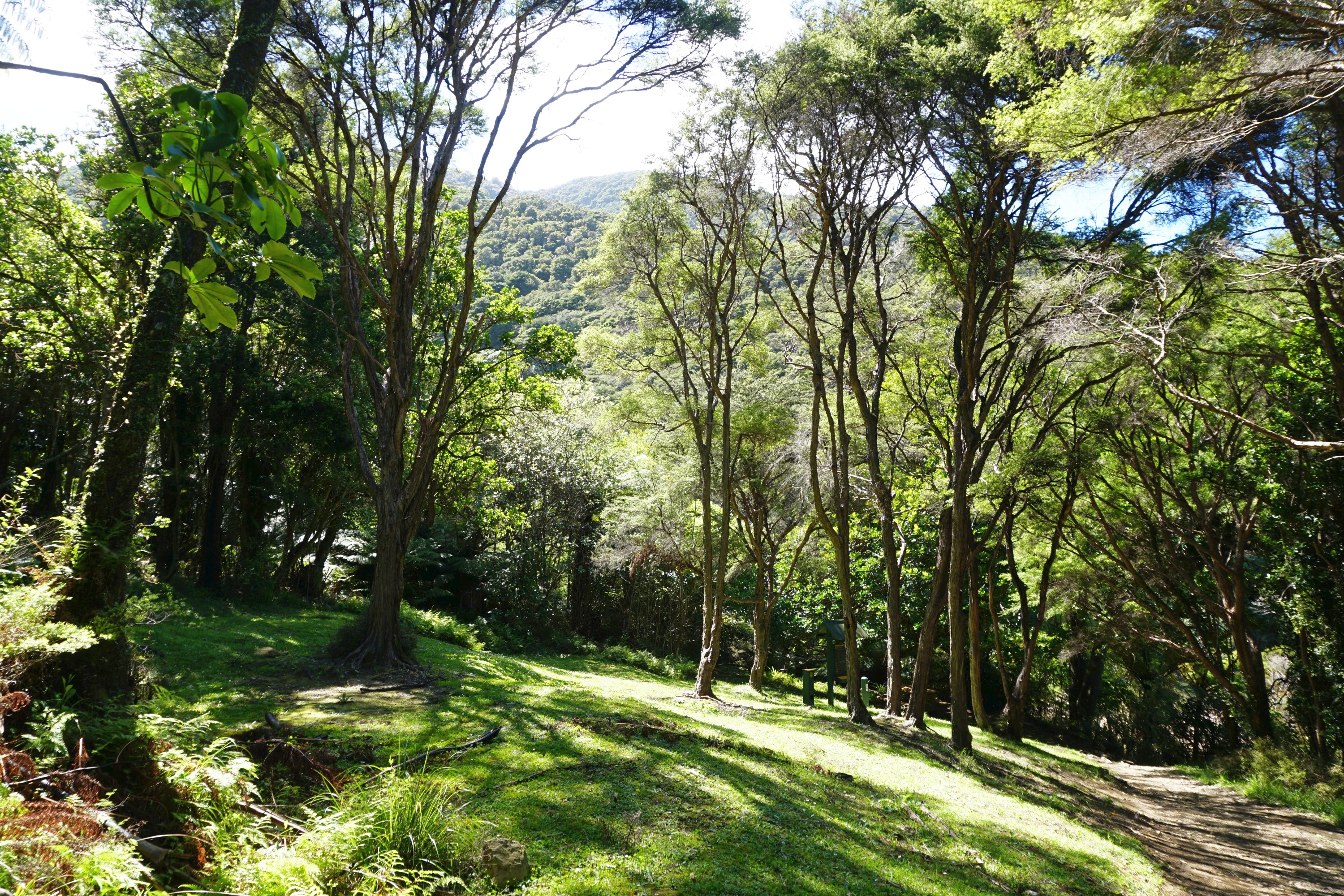
There was a lovely short section of track through towering gravity defying tree ferns.


At the head of Endeavour Inlet was the longest bridge on the track and a rusting tractor.


After 26km and six hours of walking I was glad to reach Camp Bay Campsite by late afternoon, though I hadn’t anticipated carrying my big bag from the nearby Punga Cove resort to the campsite. For some reason I thought it’d be waiting for me at the campsite.


I arrived just after a pair of bikers from Christchurch with whom I’d played tortoise and hare all day. We were on the same water taxi out, and passed each other half a dozen times, as I caught them up when they stopped to film on their Go Pros or struggled with some of the hills.


I was a bit concerned after arriving at the camp to hear about a group of 40 people in their mid twenties on their way. They were a group of friends from Canterbury University originally who meet every year for an adventure. Thankfully only ten were staying at Camp Bay Campsite, the rest at a nearby lodge. They were pretty well behaved after an initially worrying start when they hit the beers as soon as they arrived. I was surprised that they had caught me up on the track, until I learned that they walked from Ship Cove to Furneaux Lodge and got a boat from there to Punga Cove. The next day they had 40 mountain bikes being shipped in for them to cycle onto Torea Bay and then boat back to Picton. One person in the group sorts out the logistics for their trips, pretty impressive work!

Other than them there were five other people walking the track, staying at the same campsites as me, and six bikers who were finishing the next day.
The next morning I was woken by birdsong, which is a lovely way to start the day, but perhaps not at 5am…


From Camp Bay Campsite it was straight uphill to Kenepuru Saddle, with the 24.5km of track today following the ridgeline of a peninsula between Kenepuru Sound and Queen Charlotte Sound.


There were three signposts with distances to increasingly far flung places.


It would have been cool, and much faster, riding along this section of track.


A lookout over the unimaginatively descriptive Bay of Many Coves was pretty spectacular.

The Bay of Many Coves campsite was in a great location.

There was no shortage of good views along the track, helped by perfect weather. Mid twenties, blue skies, and strong winds which helped keep relatively cool. Day two was much hillier than day one, though felt easier to me for some reason, despite being basically the same distance and duration.


Along the track are handy distance markers every 5km.


It was a nice surprise to see Picton in the distance.


The waters of Kenepuru Sound were a noticeably lighter shade of blue to Queen Charlotte Sound, possibly due to the direction of the sunlight.


The track was more enjoyable to walk along than on day one.


At Torea Saddle there was an unexpected memorial to 29 local soldiers who died in WW1 and WW2.

Just down the hill was my home for the night, the very pleasant Cowshed Campsite.


Before I could set up though I had a 600m return road walk to The Portage to collect my main bag to set up camp.
After which a dip in Portage Bay was the ideal refreshment.

The birdsong was even louder the next morning, starting from 5am. Portage Bag was calm and reflective as the sun came up.

The steepest section of track was up to Torea Saddle but the views more than compensated for the aching legs.

There were lovely views of Kenepuru Sound from the ridge on one side, and of Picton in the distance on the other side.


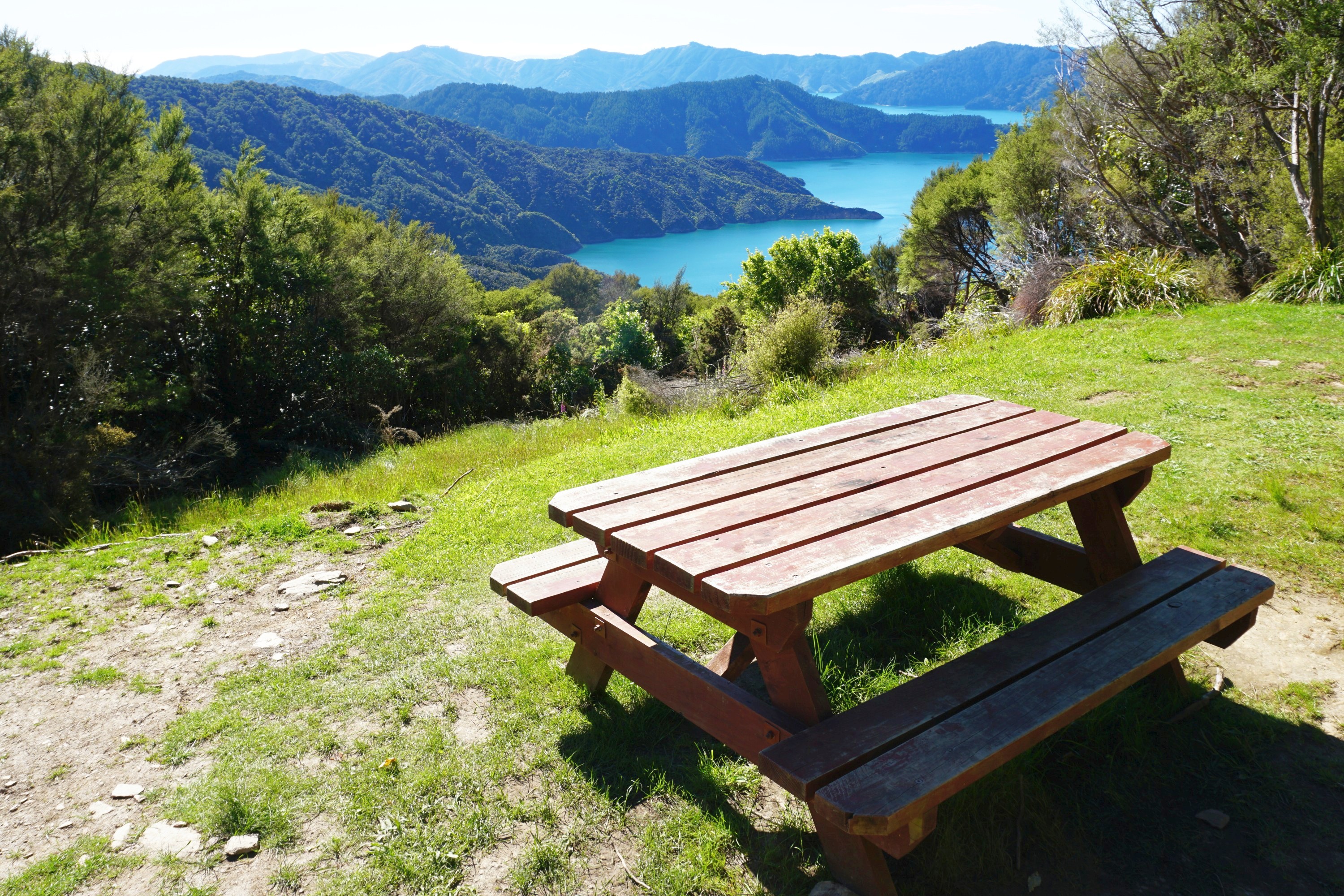
One spot with a couple of benches offered wonderful views of both Kenepuru Sound and Queen Charlotte Sound.


Along with an inquisitive weka, one of many seen along the track, particularly at the campsites.

More great views of Kenepuru Sound from the ridge, though they do become variations on a theme over the course of three days, particularly when the weather is perfect everyday as I was super lucky to have.


With about 11km to go the track became more enjoyable. While day two had arguably the best views, day three had the most interesting and varied track. Day one just felt long…


The track headed down to the water, relatively uncommon on the Queen Charlotte Track, particularly compared with the Abel Tasman Coastal Walk.


Just after noon I arrived at Anikawa, the finishing point for the track. I had nearly four hours to wait for the water taxi back to Picton, but there are worse places to spend an afternoon…


Leave a Reply