One of half a dozen excellent walkways in Wellington, the Northern Walkway runs from the Botanic Garden to Khandallah. Though it has probably the most pavement walking of the walkways, there are plenty of opportunities to disappear into the bush and escape the city. It joins up with the Skyline Walkway at Mt Kaukau if you want a particularly epic day walking two walkways back to back. There are also good public transport connections at both ends of the walkway to walk it in one direction.
One of the most beautiful parts of the city, Wellington Botanic Garden is home to a huge variety of plants and landscapes in its 25 hectares. Established in 1868 it is home to Lady Norwood Rose Garden, Begonia House (greenhouses), Treehouse Visitor Centre, and the Cable Car runs through it. It’s one of the few places in Wellington where the change of season can be seen, as most of the city is evergreen bush.


From here the walkway crosses Glenmoore Street over to Te Ahumairangi Hill (formerly known as Tinakori Hill) and into thick bush, though along a well formed dual use track. As with the other walkways the track is well marked with colour coded markers.


Oddly the best lookouts are not on the walkway, but it’s worth a detour to the excellent Stellin Memorial Park and not quite as good Te Ahumairangi Hill lookout for panoramic views of the city.


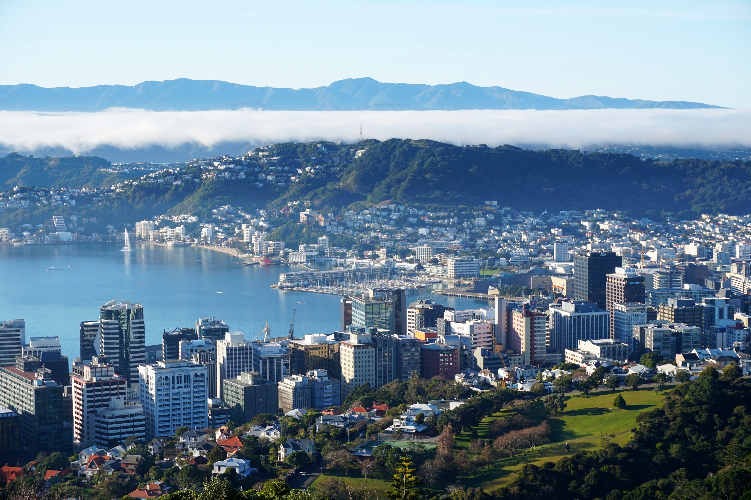
Most of these photos are from a beautiful morning in winter, with low cloud hanging behind the city.


At the northern end the bush opens up at Queens Park, providing expansive views of CentrePort and up the harbour toward the Hutt Valley.


The Sky Stadium (formerly Westpac Stadium) opened in 2000 is nicknamed the cake tin.

From here the walkway heads down through Wadestown, past some cool street art.


It returns to the bush to cut across Trelissick Park in Ngaio Gorge, through which Kaiwharawhara Stream passes through. This is the last stream in Wellington City that naturally runs into the sea rather than being built over.


After which there’s a bit of a slog along the road to Ngaio, passing some cool street art, and passing through Cummings Park, or at least attempting to as it was blocked for construction work on the play ground.


There is a way into the bush from here which I missed and headed along the road to Khandallah, the Northern Walkway branches at this point so both are viable paths to take. Khandallah Telephone Exchange from 1921 is quite an impressive building, but as is the house next door… Both are across the road from the Simla Crescent train station.


Along Simla Crescent is an entrance to Khandallah Park, one of the oldest parks in the country. The dense bush is atmospheric and filled with bird life before opening up at the summit.


After a decent slog the walkway reaches the summit of Mt Kaukau, at 445m one of the highest points in the Wellington region. There are expansive views and handy benches from which to enjoy them while eating much needed lunch after a morning spent walking.


The Northern Walkway continues a bit further from here through Khandallah Park down to a reservoir and tunnel before finishing on Elliott Street. I’ve yet to walk this section though as the appeal of returning home via public transport or walking along the Skyline Track has been a stronger lure.


Leave a Reply