Possibly Wellington’s most spectacular walk, the Skyline Walkway follows the ridge line from Makara Hill to Mt Kaukau, offering stunning views across the capital city. It takes most of a day to walk, with bus stops within 30-60 minutes of each end of the track. There are also multiple entrances / exits to the track to allow it to be done in sections. It is best done in reasonable weather, particularly lighter winds, as there is very little shelter from the elements.
I live close to an entrance / exit about a third of the way along the track so to date I’ve not walked the whole track in one go, but have walked from home to Makara and back, and out to Mt Kaukau and back, multiple times. It’s a dual use track for walkers and mountain bikers, but thankfully I’ve never seen any issues between the two. To start at the second highest point of the track, the 412m high Makara Hill.


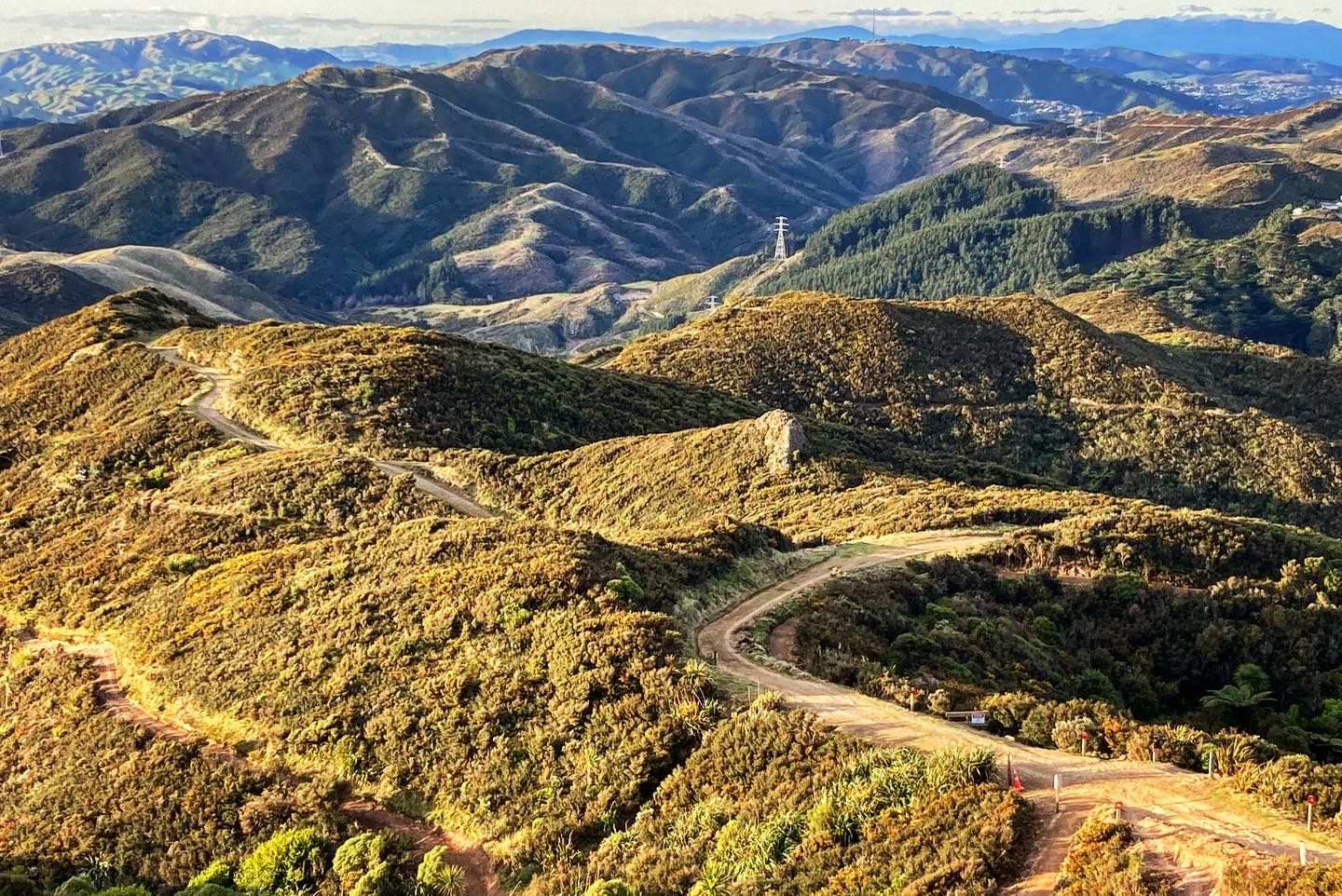
This is one of Wellington’s best mountain biking spots, with other world class mountain bike parks referenced in the locations on the yellow sign at the summit. There are incredible views over Maraka toward the coast, and the Skyline Walkway track can be traced out to Mt Kaukau in the distance.


From the summit is a steep descent down to Makara Road before heading uphill again through the most sheltered part of the track, through forested areas. Makara Cemetery can be seen in the distance below.


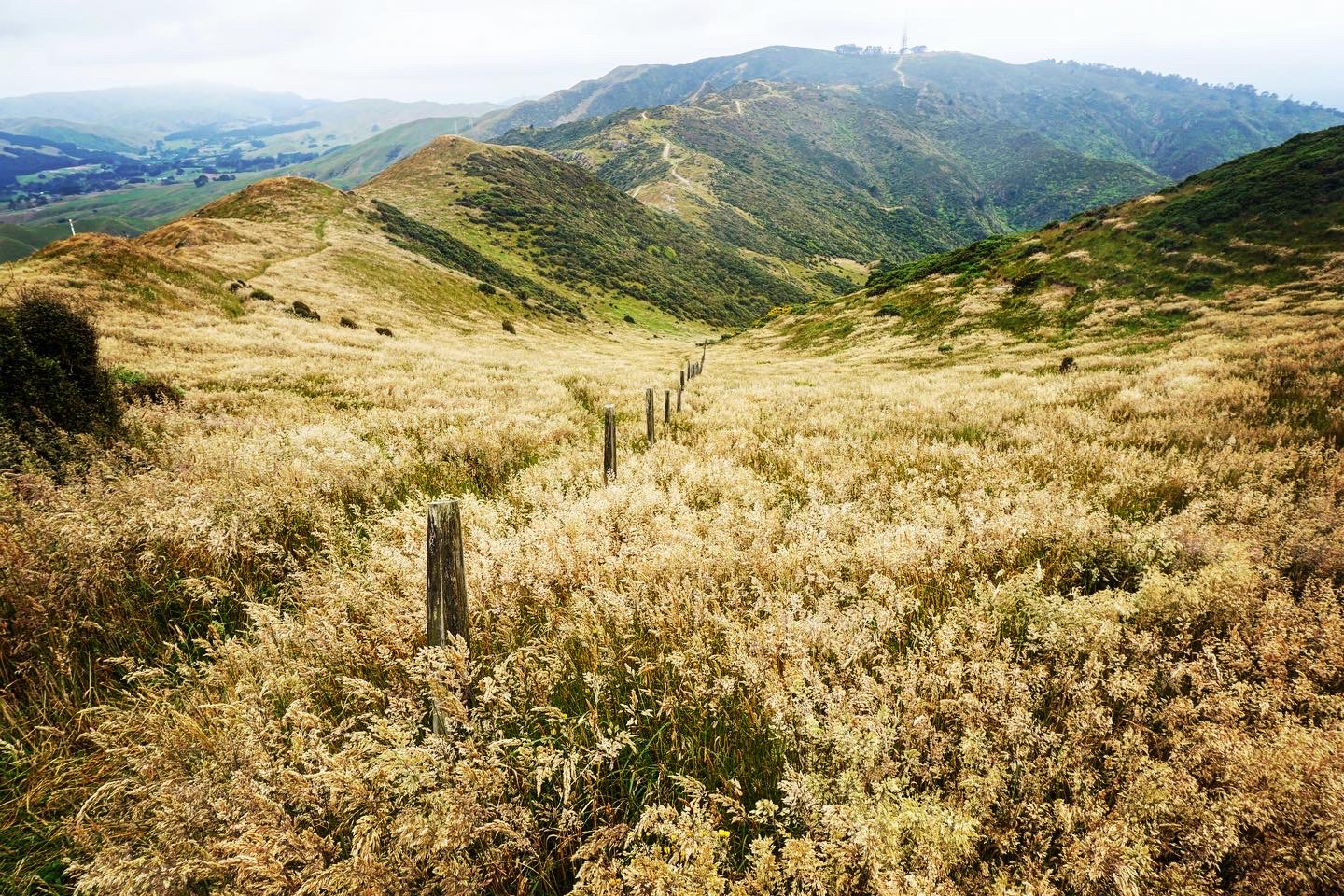
Johnston Hill is my local, somewhere I’ve been up close to 100 times, never tiring of the panoramic views from the 365m high summit. It’s a short detour from the main Skyline Walkway but one well worth making.


I headed off the main track along one of the lesser used paths for some variety and more interesting terrain, plus great views of Karori below.


My destination of Mt Kaukau could be seen in the far distance with my telephoto lens.

I returned to the main track for more views in all directions.


Below is the suburb of Crofton Downs, with new housing under development.


Ahead is the larger suburb of Khandallah, which Mt Kaukau borders. I watched the Aratere Interislander ferry come out of the Kaiwharawhara terminal, stop in the harbour, then turn around and head back to port. I thought it might have been for a medical emergency but later learnt that the ship was out of service and they were testing something.


Further along the track a short detour goes to the 385m Crows Nest, looking out over the suburb of Crofton Downs below.
Mt Kaukau seems closer than it actual is, with the climb to the summit one of the steeper parts of the track (similar to Makara Hill).


At 445m Mt Kaukau is both the highest point on the Skyline Walkway and one of the highest points in the Wellington region. There are a number of benches, making this an ideal spot for lunch with a view, and slightly better views can be found from the elevated lookout platform. You can see nearly every part of the city from here, including the CBD, Porirua, the Hutt Valley, Makara, and across to the South Island (with snow capped Kaikoura mountains) From here is a descent through attractive native bush to Khandallah where there are bus and train options back to the city.


Leave a Reply