The Waitakere Ranges are 16,000 hectares of native rainforest 40 mins drive from Auckland CBD. With over 140 tracks, generally well sign posted and maintained, they’re the perfect place to escape the city for a few hours or days (if you do the up to four day Hillary Trail). I’ve walked 27 of the tracks around Karekare and Piha, here are my favourites, followed by some handy links.
Laird Thomson Track
Probably my favourite track, thanks to stunning views over both Piha and Whites beaches, accessed via a headland with views along the west coast, and home to a couple of well located benches. It is also one of the easiest and most accessible tracks, starting from the end of North Piha beach.


Zion Hill Track
Head up the hillside from Karekare up to the Zion Ridge Track. On your way up you’ll have behind you some lovely open sections with panoramic views across toward Karekare beach.

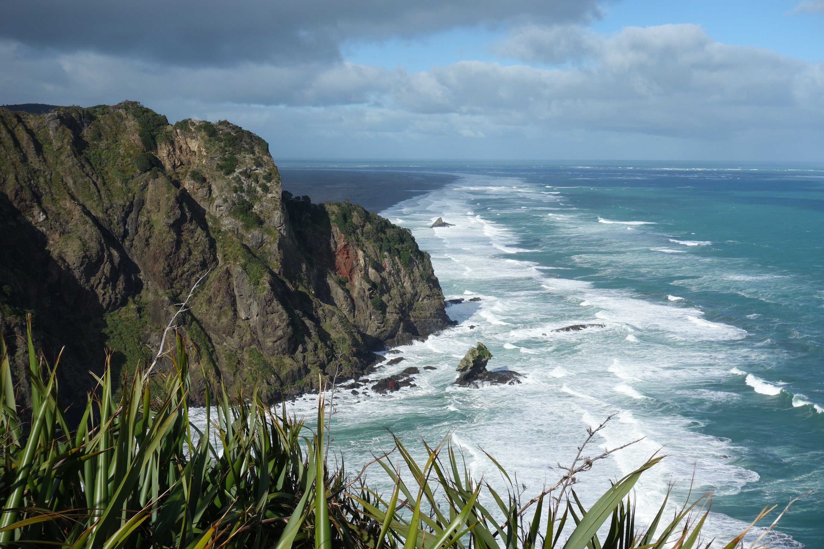
Comans Track to Te Ahua Point
More spectacular views along the west coast from north Karekare. Te Ahua Point was home to one of the most impressively located Maori settlements. The track joins onto Mercer Bay Loop, leading to the remains of the WW2 Karekare radar station which are well worth a visit.


Kauri Grove Track
My pick of the inland tracks, with a number of huge Kauri trees to be found along it. Just make sure your boots are clean before you tramp to avoid spreading Kauri dieback disease.


Useful links
The three best resources I’ve found for planning tramps around the Waitakere Ranges are:
– Topomaps, free, pretty detailed maps including nearly all the tracks
– Auckland Hiking Group on MeetUp, their archives have trips that include every track in the ranges
– Fathmandu, a comprehensive list of all the tracks with details


Leave a Reply