To really appreciate what four million people look like in a country 10% bigger than the UK you need to see New Zealand from the air. Vast amounts of farmland, forests, mountains, and volcanoes, plus the occasional settlement lie below.
Mt Cook
Despite visiting it twice the only time I’ve seen the top of New Zealand’s highest mountain, Mt Cook, was flying over it, with the peak rising through the clouds.

Cardrona
One of the better known ski fields in the Southern Alps, close to Wanaka, looks quite different from above than hurtling down it. Also quite a difference with and without snow!


Queenstown
Beautiful from any angle, but particularly as the sun set over Lake Wakatipu.


Wanaka
Water and mountains are a powerful combination, and put Wanaka in scale with its beautiful surroundings.

Southern Alps
Running the length of the South Island and a highlight of flying to or from Queenstown, spectacular at any time of year.


Christchurch and Canterbury plains
A pretty undistinctive city from the air, but there are some huge river systems flowing across the Canterbury plains from the Southern Alps.


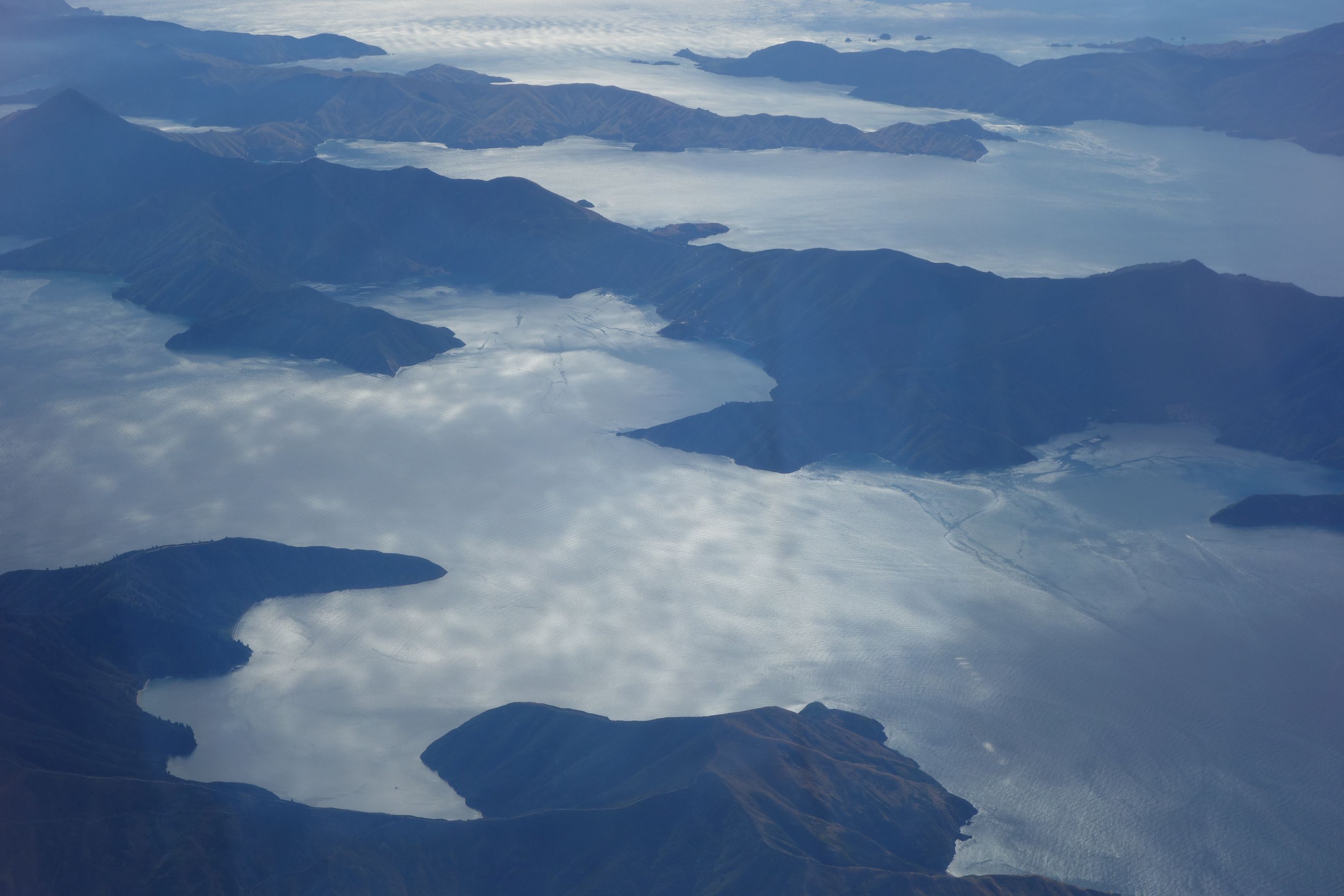
Marlborough Sounds
Beautiful by boat but even more spectacular by air into and out of Nelson, particularly when the sun hits the water like this.


Nelson, Picton and Blenheim
A trio of charming places at the top of the South Island, perfect for those who love tramping (hiking), sailing and wine.


Stewart Island
South of the South Island lies this gem, home to about 150 people, Great White sharks, and lots of visiting trampers (hikers) walking the Rakiura Track Great Walk, or the epic North West and Southern Circuits for those keen on spending 8-14 days walking through bush and waist deep mud.


Leave a Reply