Well known to Australians but far less to others, the Kokoda Track in Papua New Guinea was the site of one of the key battles in the Pacific during WW2. A small number of Australian troops defended successful against a much larger Japanese force hoping to capture Port Moresby overland, after being defeated approaching by sea.

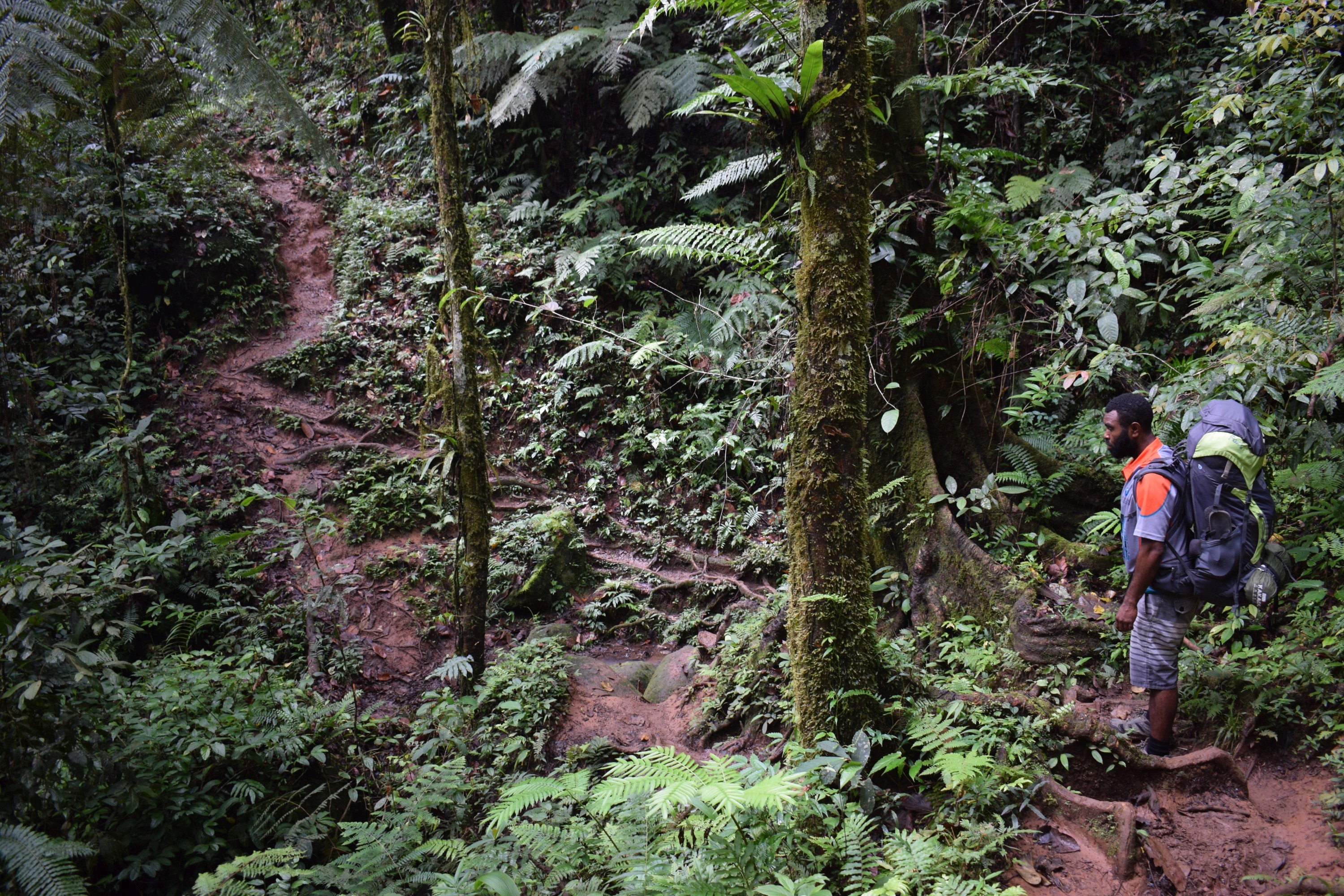
Mostly (about 3/4 apparently) following the original existing trail fought over, the Kokoda Track is a 96km hike between Owers’ Corner and Kokoda (usually done the other way round), with around 6,000m of ascent and descent through thick tropical rainforest. It was a brutal experience during the war, now it is an at times challenging hike, mainly due to steep and often slippery climbs and descents, a number of river crossings, and tropical heat and humidity, particular in the lower sections.

I walked it at the start of June, early in the dry season (close to when the battle was fought, between July and November 1942), over seven days. The locals can walk it in four, while tours take between six and twelve days. It can be done independently but isn’t recommended from a safety perspective, both in terms the remoteness and roughness of the track, and that you’re passing through land owned by local tribes. Local rangers strongly encourage use of a guide, it is almost always done as part of a group, with porters and usually an historian. There are no roads between Owers’ Corner and Kokoda, most things are either locally grown or carried in on foot, though a couple of the largest villages have airstrips with weekly service planes bringing in larger loads.
I walked it with South Sea Horizons, one of only a handful of PNG owned company operating on the track. Australians have a near monopoly, understandable given the reason for interest in the track, and that the vast majority of walkers are Australian, but sad to see money going offshore from a poor country in need of development.

From Port Moresby it was about an hour and half along an increasingly twisty if scenic road out to Owers’ Corner. From there our group of three, myself and a couple of younger Australian guys, and crew of seven, a lead guide, historian, and five porters, set off to spend the next week together.

The first section was representative of much of the track, a steep and slippery clay path descending down to the Goldie River, though usually we’d be surrounded by forest rather than being in the open.

Crossing the Goldie River was the first challenge, being one of the deepest and widest rivers I’ve crossed, with fast flowing water up to my mid-thigh. It’s important to try and keep your boots dry on the track, so they’re taken off whenever it’s not possible to rock hop safely.

Unfortunately in the process of removing my phone from my pocket I basically ended up throwing it in the river. Thankfully a quick recovery and dry resulted it seemingly being fine. Still not an ideal start…
We then got into the track proper, which requires near constant focus on your feet to avoid slipping on clay or mud (though nothing deep) or tripping on tree roots.

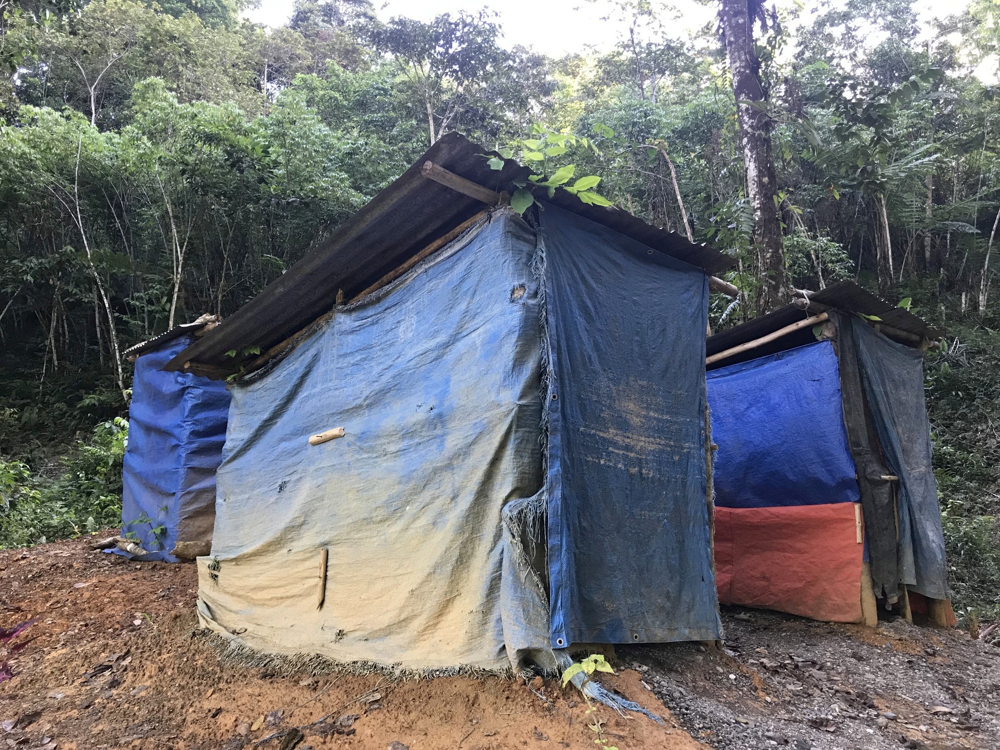
We had an early lunch at the Good Water campsite, not the nicest one but representative of campsites on the track. They usually have three huts, two for the crew to cook and sleep in, one for groups to sleep in, a covered eating area, and a large grassy space for tents. Before we left the Adventure Kokoda (the largest operator on the track) crew had set up 13 tents for their group also starting from Owers’ Corner today, though as they were taking ten days we never saw them. I was very happy with our much smaller group, made everything much easier.


An hour uphill along the Golden staircase brought us up to Imita Ridge, to which Australian troops carried a 25 pounder gun weighing 1.25 tons, to shell Japanese positions on other ridges. Here was the first of a number of helpful plaques explaining what happening here in 1942, complementing our local historian. This was the closest to Japanese got to Port Moresby before receiving the order to retreat.


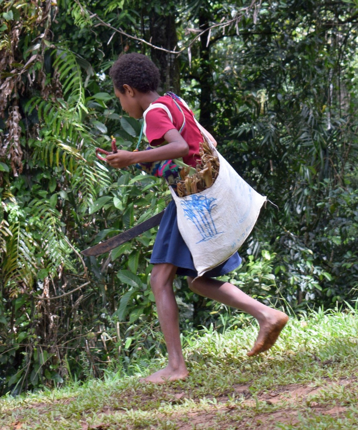
On the ridge were some locals taking advantage of rare mobile phone reception. They were on their way to Port Moresby to sell nuts, a five day round trip from their village! One of the kids had a handy machete, a frequent sight in Papua New Guinea.
From here it was downhill before crossing a river eight times, walking in hiking sandals rather than boots. After about four and half hour of walking, covering around 10km, we finished day one at the quite beautiful Va’ule Creek campsite.

We set up in one of the huts, which had plenty of space, and was cooler and lot less effort than sorting out tents. Amazingly there were no mosquitoes around, quite unexpected and welcome.

The creek was a wonderful place to sit in, wash and cool down.

There are reasonable long drop toilets at all the campsites along the track, though at Va’ule Creek campsite they required a little effort to reach.


Lying on lush grass sketching our hut was a blissful way to spend the end of the afternoon.

After dinner the crew unexpectedly sang us three songs, including their team song ‘Is Not An Easy Road’, a lovely touch. After an eventful first day we crashed out to bed at half seven, despite the near deafening noise of the jungle at night, crickets, river and birds, and high humidity.


Leave a Reply