An excellent 16km circuit toward the 2,139m high Crna Glava, the highest peak in the Bjelasica Mountains in northern Montenegeo. The scenery was the near equal of day hikes I’ve done in Switzerland but I only saw three other hikers all day. The walking was mostly on 4WD tracks so rather too easy, but meant that the views could be appreciated without tripping over…
After heavy rain the previous evening there was welcome sunshine to start the day. I slept in shepherd huts at Katun Vranjak, cosy and atmospheric.

The walk was straight uphill, with the huts getting increasingly small below.


There were many beautiful meadows of wild flowers.

The play of sun, cloud and mist was ideal for photography.

There was still a fair amount of snow / ice around in mid June.

I walked by the Kolasin Ski Centre.


And continued uphill toward a prominent antenna complex, as the sun continued to break through gaps in the clouds.

This was a pretty good panorama to enjoy while walking.


It is sad the damage 4WD vehicles can do to the landscape, particularly when there was already a road in place. This was just a shortcut someone had made.

I stopped for lunch with a view!

Walking out to the end of this minor peak gave some different perspectives on this amazing landscape.


The snow patches were pretty sizeable up close.

A small herd of horses wandered by…

An attractive alpine lake came into view below.

I walked part way down toward it to join the side path toward Crna Glava. Visibility disappeared and the forecast was for rain from late morning so I very nearly skipped it to complete the circuit back to the start.

But thankfully the mist cleared and the black clouds passed, though it was overcast for most of the rest of the day. Not so good for photography but as it stayed dry until an hour after I finished it turned out much better than expected. The views looking back toward the lake and antenna were pretty good still.


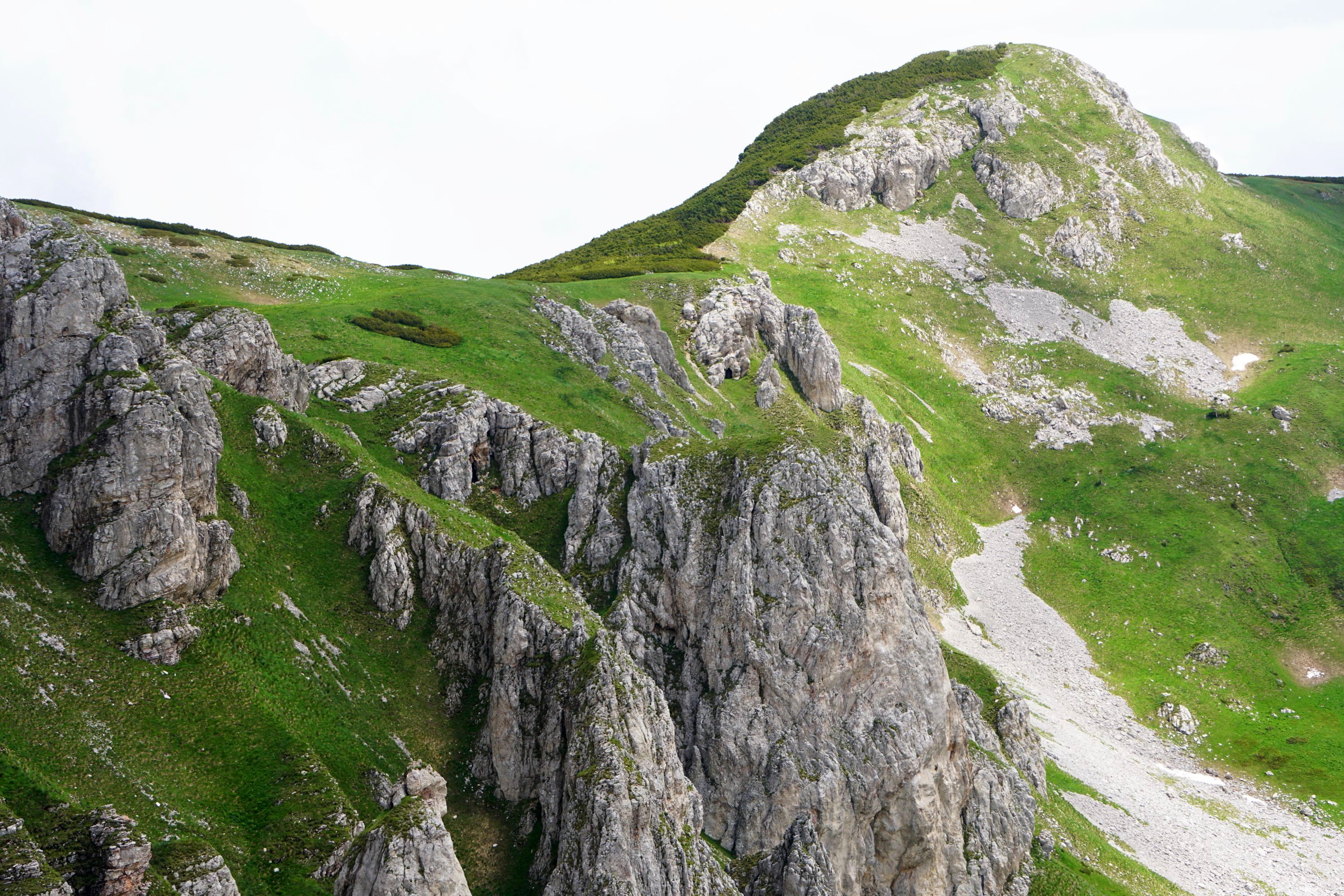
Crna Glava Is the peak on the centre of the photo below. Oddly, despite being the highest peak in the Bjelasica Mountains, it is the only forested peak.

With the weather still looking uncertain and only being half way round the circuit I didn’t make it to the summit, but turned back at this point.


There were endless white flowers covering the hillside.


It was all dirt road back from here, and initially similar views.


This short section of forest made a welcome change though.


And the landscape changed, there were consistently good views the whole way round the circuit.


More views heading up the road.


Which was impassable to vehicles, thanks to a rather serious slip and a large patch of ice.


I came full circle by the boundary to the ski field before heading back down to the huts.


And finished the day with a colourful sunset.


Leave a Reply