A 600 hectare reserve on the south coast of Wellington, Te Kopahou Reserve is one of the most spectacular places in the city, home to fur seals, stunning views, WW2 observation bunkers, historic baches, colourful rocks, radar domes, and a castle! It also entirely exposed to the full force of the elements, so best explored on a calm and clear day.
To start with the most popular part of the reserve, the Red Rocks – Pariwhero Coastal Walk, which runs from Owhiro Bay Quarry out to the fur seal colony at Devil’s Gate below Sinclair Head. As a walker this is best visited on Sundays, otherwise expect to be dodging a constant stream of 4WDs testing their vehicles on the black sand.


Along the way are four historic baches (kiwi holiday homes), built between 1900 and the 1940s, which have been handed down through families over generations.


The red rocks live up to their name, and were formed by underwater volcanic eruptions about 200 million years ago.


You can often smell the New Zealand fur seals at Devil’s Gate before you can see then, with their colour blending in the rocks more than their odour. There are up to 150 of them between May and October, all males getting in condition for the breeding season.


The rest of the reserve requires a bit more effort to explore, with the 495m summit of Hawkins Hill being one of the highest points in the city, two and half times the height of Mt Victoria. You can make things a little easier though by starting from the car park by the 299m summit of Brooklyn Hill. This is marked with the landmark wind turbine, which is where the first wind turbine in New Zealand was installed, though it was replaced in 2016 with the current, more powerful one, which can power up to 490 homes.

The views from here early on a perfect winter’s day, with blue skies and almost no wind, were quite breathtaking, almost literally as it was 2C when I left the house…

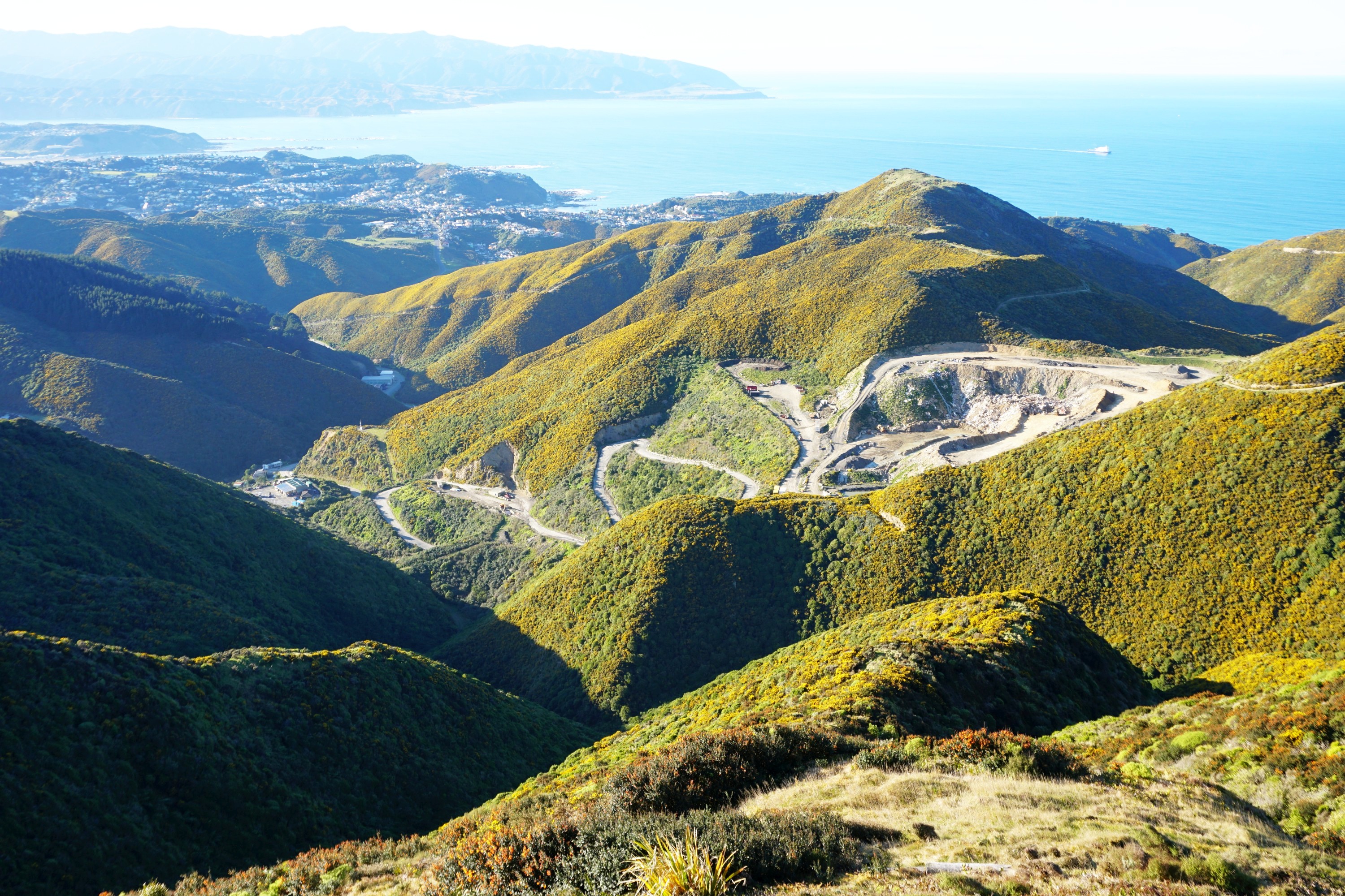
In the distance across the harbour I could see Petone, with the Tararua Ranges in the distance.

The Southern Landfill is a prominent feature in the valley below, best admired from a distance.

From here I walked along the Zealandia Predator Fence Track before rejoining the adjacent Hawkin’s Hill Road. This had a gate installed in 2018 to reduce the volume of traffic on the narrow road frequently used by walkers and cyclists, along which are some unexpected houses, in amazing locations.


Just behind the Hawkins Hill Northern VHF Station is a wonderful lookout spot, marked by a couple of rusty metal poles. Beyond is the city, and below the Southern Landfill, possibly one of the most scenically located tips in the world.


Just up the road is Woofington’s Luxury Dog Stay, originally built as a castle themed conference centre by converting a decommissioned 1970s radar bunker. A somewhat unexpected sight!


Behind it is the Hawkins Hill Radar Dome, containing equipment used by Wellington and Christchurch airports, a somewhat surreal object when viewed from the road, like one of the bubbles from The Prisoner.


Ahead is the expanse of the reserve heading out to the Cook Strait, and to the left across the mouth of the harbour is Pencarrow Head.


A constant presence are the three Interislander ferries, and two Bluebridge ferries, heading out of Wellington Harbour to cross the Cook Strait to Picton at the top of the South Island.

Unfortunately the 485m summit of Te Kopahou is on private land belonging to the Long Gully Station. There was a proposal a few years ago to build a wind farm on this land, but there wasn’t sufficient demand to make it economic. It used to be popular with mountain bikers but the new owners have been strict about preventing anyone on the land unfortunately after a few incidents.

From here it was nearly all downhill, increasingly so, toward Sinclair Head, with wonderful views ahead. I was glad to be wearing trousers given the amount of gorse around, which is razor sharp as I discovered when I grabbed some of it after nearly slipping on loose scree.


Sinclair Head is home to a number of observation posts from WW2, and previously was the sight of an early Maori settlement site.


It made the perfect spot for lunch, with stunning views of the top of the South Island, including the snow capped Kaikoura Ranges, across the Cook Strait.


Below I saw one 4WD, then another, then an entire convoy drive along. Clearly it’s the place to come at the weekend if you have a 4WD…

From here it was almost entirely uphill, other than a steep descent down to Waipapa stream, followed by an equally steep climb up, though I took the Red Rocks Track on the right which didn’t look quite as steep as the Radome Track on the left.


I got to see the Southern Landfill from another angle on the return, before finishing back at the Brooklyn Hill Wind Turbine quite satisfied after a stunning 15.5km circuit of this beautiful place.


Leave a Reply