The second and more typical day walking 100km around the North West Circuit, with epic beaches and gruelling climbs up muddy hillsides. Although it was the same distance (15km) as the first day it took me twice as long to reach Big Hellfire Hut as it had to reach Mason Bay Hut.
The scenery changed again heading along Duck Creek to Mason Bay.


This was where I had planned to be dropped off the previous day, and a guy from the hut had hoped to be picked up today. I didn’t see a plane though when it was due, suggesting that low cloud in Invercargill had cancelled the flight for a second day running.
The mouth of the creek was pretty scenic, if the unexpected location for a swarm of sandflies to attack me. Unusually I’d applied insect repellent that morning, after being eaten alive on a recent hike along the Old Ghost Road I thought I’d try it. The repellent didn’t seem to stop them though…

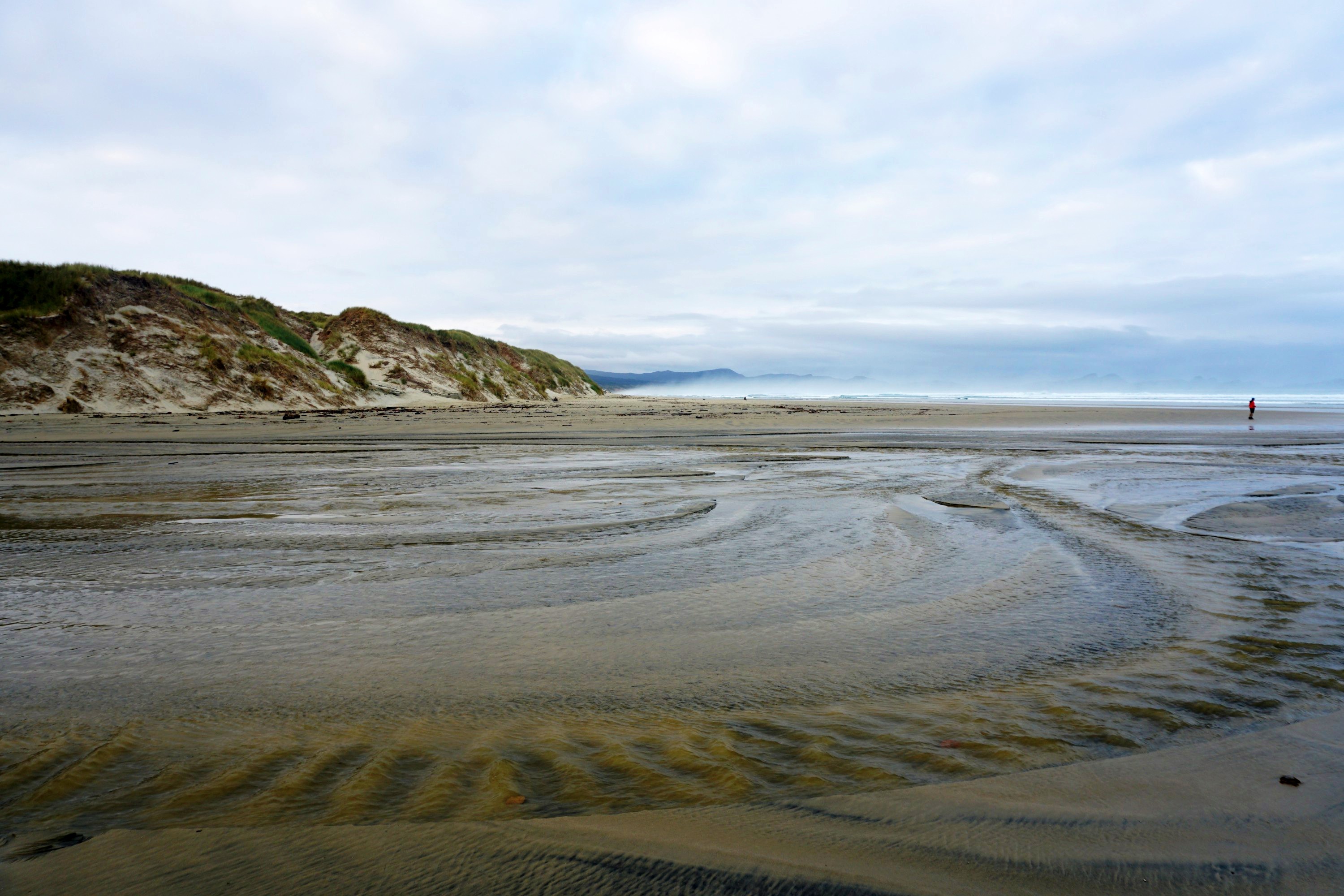
Mason Bay is the largest beach on the island, a 12km stretch of sand, backed with impressive dunes beneath epic skies.


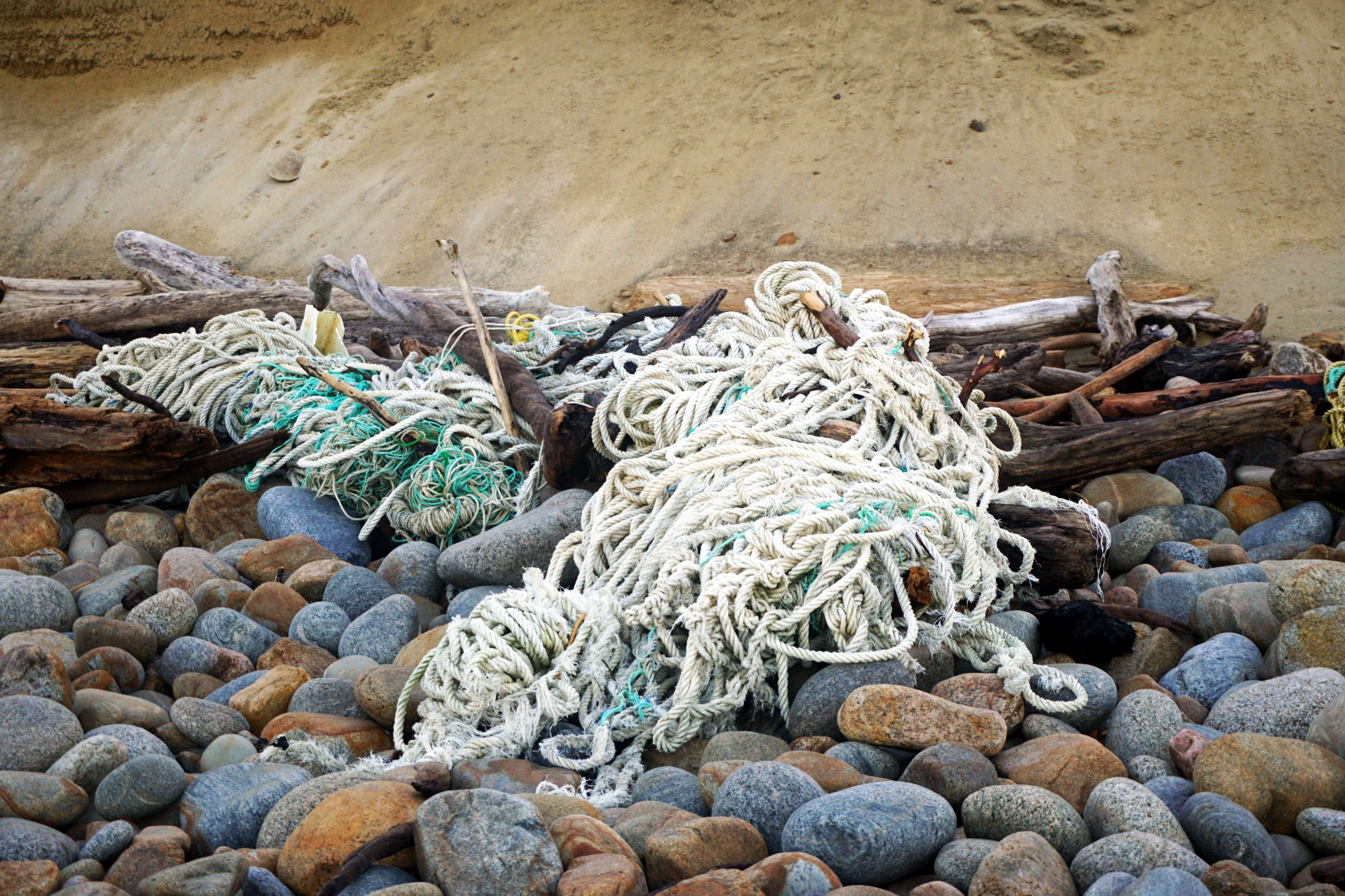
There was a substantial amount of driftwood at the high tide mark, unfortunately along with a significant amount of washed up rubbish, plastic and ropes mainly. This seemed to be a west coast beach issue, those on the northern and eastern sides were fine, presumably relating to the prevailing currents.


I’d timed my trip around the tides as the beach is only navigable within 3-4 hours of low tide, and the alternative across the sand dunes is tough going. Even walking within an hour of low tide I was forced onto the rocks at the northern end.

From here the track went from fast, flat and sandy / rocky to slow, steep and muddy. It took a couple of hours to get over a ~300m headland in hot and muddy conditions, despite the cloud cover. Near the highest point I came across five people heading south. The older group of four had left Big Hellfire Hut at 6am to try and reach Mason Bay in time for the tides, but they were still cutting it fine…


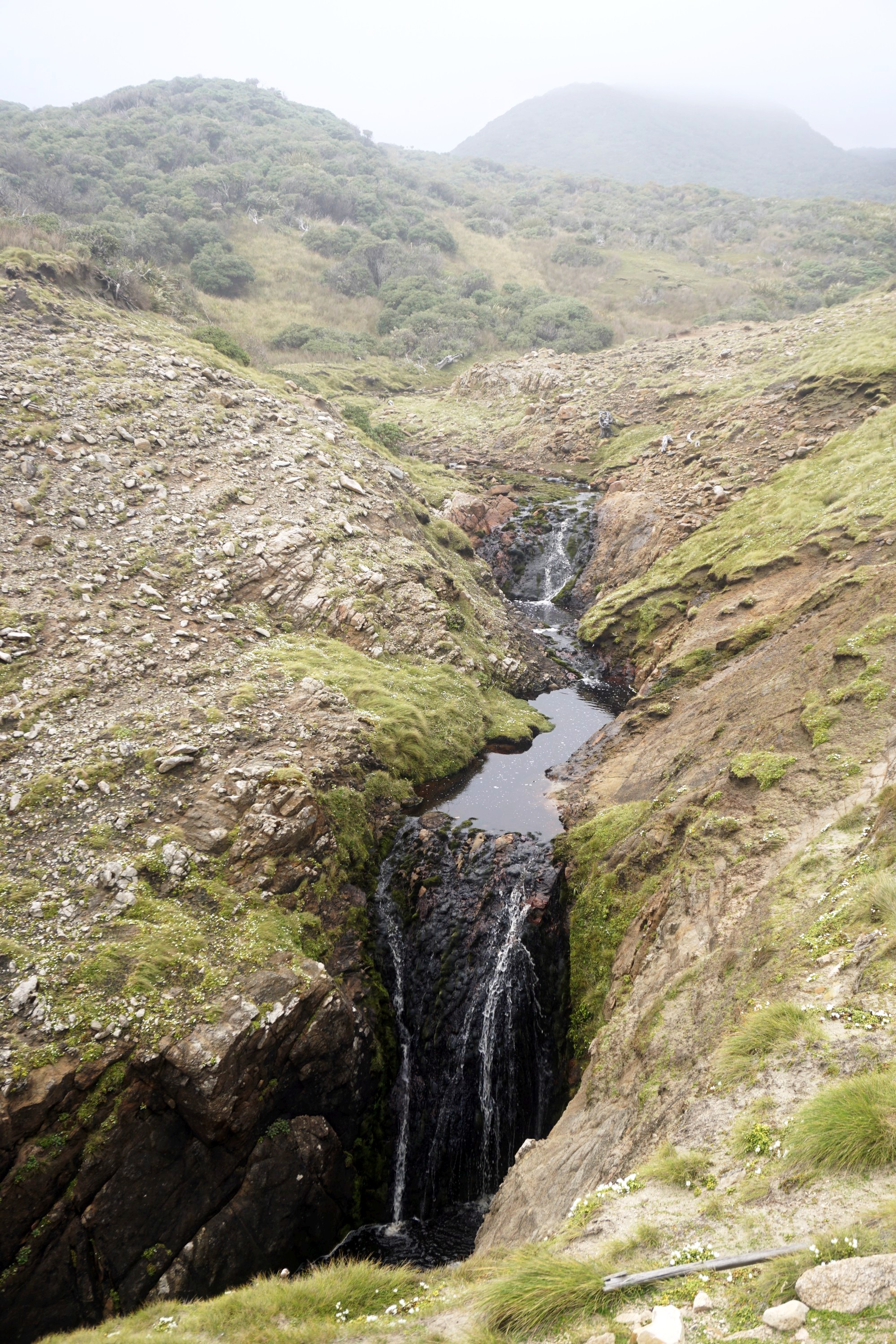
Thankfully it was less steep coming down than going up, and I was greeted by big views, and an unexpected waterfall and orange glove at Little Hellfire Beach.


The hardest part was still to come though, with another steep and muddy climb to the highest point of the track, ~400m above sea level. I hadn’t gotten far up hill before a brief lapse in concentration resulted in my first dunked boot of the trip. There would be more to come plus a couple of trips / cuts / falls. My pack was higher than my head, and the branches were often lower…


After a couple of hours my efforts were at least rewarded by some views.

This patch of mud was almost attractive, covered with fallen red needles.

The bush was quite varied and atmospheric but I was seriously flagging by this point, having pushed on without breaks to reach the hut before having lunch.


I finally reached the lovely Big Hellfire Hut by half two and basically collapsed, before summoning enough energy to make and eat lunch.


This is a great ten bunk hut which I was lucky enough to have to myself. Through gaps in the bush line were views of the 360m high Benson Peak, part of the Ruggedy Mountains.

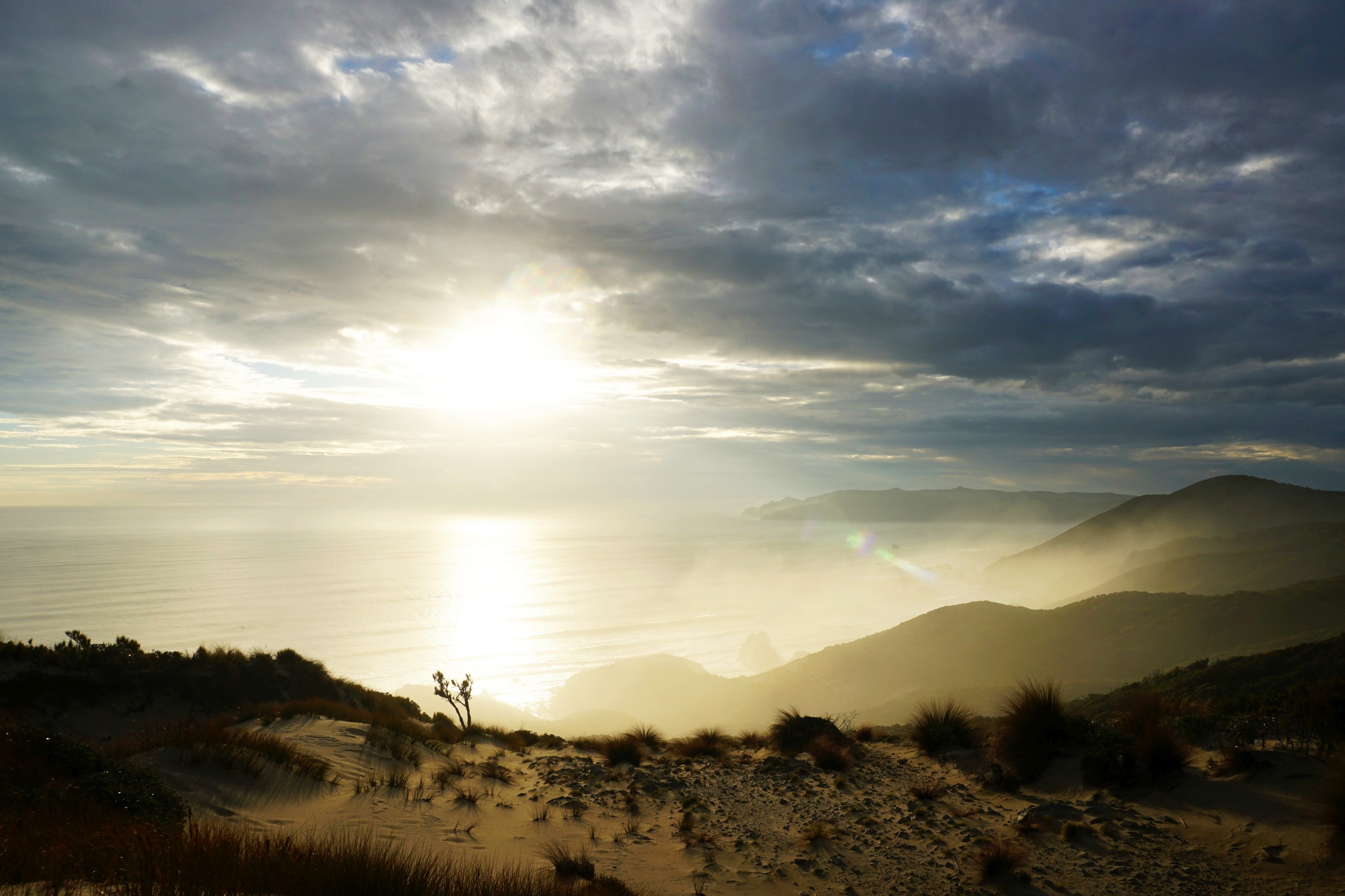
A discovery heading to the toilet was that the hut is built on a ~200m high sand dune, which opened up a minute’s walk away from the hut to expansive views of the Ruggedy Mountains and lowlands in one direction…


…and incredible views of Big Hellfire Beach in the other direction.

To finish with a return to the dunes to watch the sunset. I was the only person within at least seven hours walk, moments like this are the reason I go tramping.


Leave a Reply