The start of a three week hike around Kanchenjunga, the third highest mountain in the world. It lies on the far eastern border between Nepal and India, and unlike many of the Himalayan giants it stands alone rather than as part of a range. The hike would take me, and nine others travelling with The Mountain Company, from the jungle like lowlands to over 5,000m above sea level, and back in a circuit around the Nepalese side of the mountain.
First we had to get close to the mountain, which took a while! First I had three flights from Wellington to Kathmandu, then a flight to Bhadrapur in eastern Nepal, followed by ~10 hours of driving along incredibly winding roads, thankfully split over two days (one day on the way back!). Throw in over seven hours of jet lag and I was in a pretty exhausted state before I even started hiking.
The drive was memorable though, with some surprisingly lush scenery, I wasn’t expecting Nepal to look like Papa New Guinea in places. The road was sealed the whole way, but pretty narrow and there were plenty of trucks to overtake with little space to do so.


Along the way I saw about half a dozen white motorbikes, presumably the same as the white bicycle movement, placed where people have died on the road, or used as a warning.

We got our first view of Kanchenjunga in the distance, with the prominent Janna peak (7,710m) on the left, and three main peaks (the highest is 8,586m) to the right. The main peak is shared between Nepal and India.


The towns we passed through were busy places, with lots of construction going on, and colourful buildings.


At one stop by a large memorial gate I spotted this cricket like creature.


There were some impressive terraces on the hillside, and houses everywhere.

After lunch we finally started walking, through the bustling town of Taplejung, with attractively colourful houses. Day one was all downhill, about 800m over 10km down to the Tamur river on a hot day.


The town turned to countryside, with decorative tractors.

There were some big views down the valley.

And more attractive houses in a small village.


I don’t know what these distinctive trees are but they’re beautiful.

The Gurkhas built this bridge in 2003-2004.

And a preying mantis in the middle of the track.

We reached Mitlung, our home for the night by dusk, a villagers front lawn filled with our tents.

I didn’t hear anything (as I had ear plugs) but others in the group heard construction noise all night. We walked past the culprit in the morning, a large hydroelectric scheme under construction.


The second day was basically up the valley along a 4WD track, not the most interesting walk but the views were scenic.

And the villages, I think this one was Thiwa Khola, were colourful.


At the base of the valley is the Tamur River, with a few streams flowing into it to cross.


It was super hot today, so after three hours walk it was a relief to have a long lunch break in the garden of this villagers house and hide in the shade.

After which we caught up with our porters. Some how they can carry 35kg or more on their heads, while wearing jeans and trainers, and walk faster than us with day packs and poles.

More scenery and attractive houses followed.


It was a relief to reach our campsite by a field just before the village of Chirwa, and escape from the sun and heat. Both of these disappeared though by 3pm, downside of the tall mountains, with the 4,252m high Khokling peak close by.

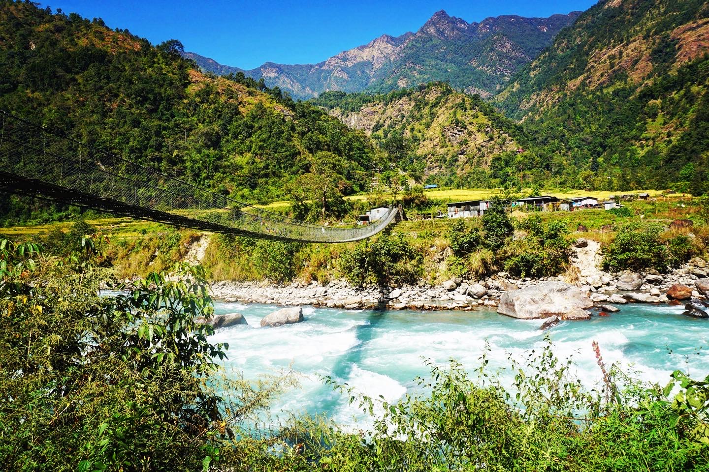
Day three was the most enjoyable so far, finally escaping 4WD tracks, and while hot there was a cool breeze and more shade. From Chirwa we continued along by the Tamur River, over which some impressive bridges cross.

We finally crossed over it at Taplechok, the entrance to the Kanchenjunga National Park where our permits were checked. As with many of the more remote parts of Nepal permits are required, secured through local companies. We saw a number of independent hikers on the circuit though, unsure if they had permits or not. In the past camping was required to complete the circuit, but there are now enough guest houses that it can be walked unsupported.


There were some lovely fields that looked ready to harvest soon. It’s a surprisingly tropical environment here, with bananas growing.

The track was definitely more interesting today, a cobbled type affair running alongside the river.


We crossed the Tamur River again via the pedestrian bridge rather than the new road bridge. Common with seemingly all parts of the Himalayas is that every year there are new roads, impacting the hiking, but bringing access to remote villages. Almost all of them seemed to have mobile reception, and power judging by the number of lights on the hillsides at night.


We crossed over into the narrower Ghunsa Khola Valley.

Where there was a rather large slip to carefully navigate.

Soon after was the village of Sekathum, where we spent the night in a beautiful spot.


To finish with our first relatively close glimpse of Jannu, peaking out above the end of the valley.


Leave a Reply