For the detailed route and logistical information please select this hike below (click top left for the list of hikes).
One of the harder hikes I’ve done in Dili, this took me about 3.15 hours (with breaks) to hike ~11km along the ridgeline behind Tasi Tolu in west Dili. I was rewarded with incredible views for much of the way, a sense of remoteness close to the city, and a constant fear of dogs (which is pretty standard when I’m hiking alone in Timor).
Dili has an extensive microlet public bus system, which is great for being able to plan hikes with transport at each end. I started by catching the #10 microlet out to Uma Adat São Paulo II, a memorial to the 1989 visit of Pope John Paul II. From here it was a relatively short walk along the road toward the statue of Pope John Paul II, which I’d visited the previous weekend. I started up the steps toward the statue but half way turned left rather than right and headed off the road and onto relatively clear tracks by Timor standards. These offered views of the Tasi Tolu lakes below, the coastline of Liquiçá (as the Dili municipality ends at Dili Rock), and a flash new resort being built in the hillside above.


The views got even better as I climbed, with the airport and Cristo Rei visible in the distance.


From the top of the ridge I could see more clearer across in Liquiçá, as well as over the Tasi Tolu lakes, and Atauro Island in the distance.


There were a multitude of potential tracks along here, so I keep to the top of the ridge as much as possible, and came out onto a much wider and more obvious path. The downside was the lack of shade!


This offered more good views of Liquiçá, including of the recently built new Dili port, and the hills behind Liquiçá leading up to Ermera.


Hiking with views and paths like this is pretty pleasant!


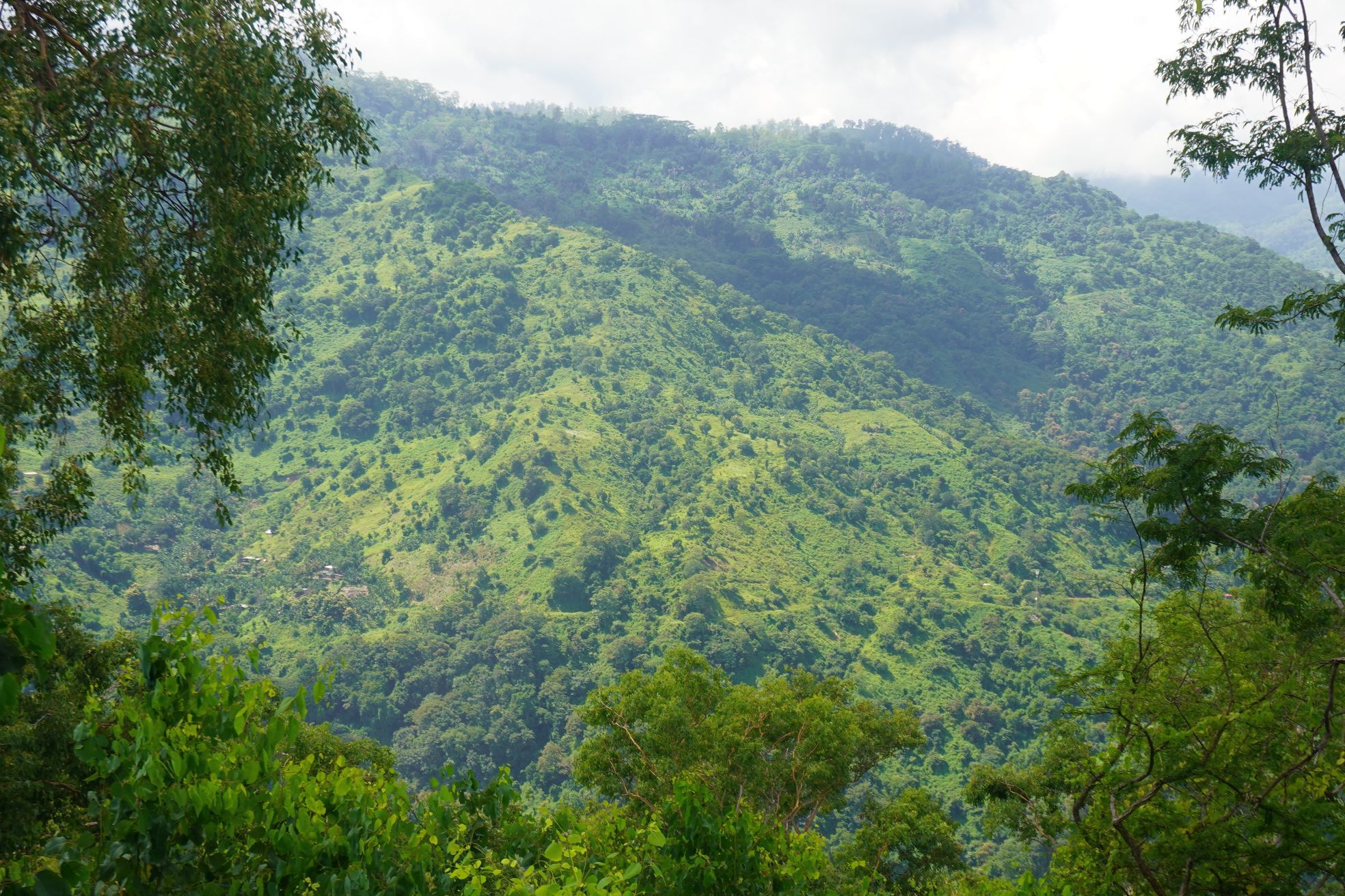
The sea views were replaced with views of sun and cloud covered hills, which from a distance reminded me of back home in New Zealand.


A more loop like route heads along the ridges around the lakes, but I decided to take the more remote path out to Comoro river, which was a little rougher and overgrown!


People still live around here though, with large piles of firewood probably waiting to be carried down to Dili to be sold around Taibesi Market. Finally the climbing part of the hike was over. It was about ~375m in total, but the Dili heat, humidity and sunshine was driving me toward heat stroke territory, so it was a relief to find a rough road heading down toward the river.


It was a relief to finally see the Comoro river below. It is pretty industrial and while shallow enough to cross on foot in early April, it has been known to flood badly, illustrated by the width of the river banks.

It is a popular place for building supplies, with quarries and people removing gravel and sand from the river bed for use in construction.


Leave a Reply