Day 6 hiking coast to coast across beautiful Timor-Leste was an unexpected treat. Due to bad weather on day 4 we changed our plan and walked a different route to usual itinerary. The upside of this was visiting Dokomali Falls, probably the most spectacular waterfall in the country.
There was a great combination of sunshine and cloud heading out of Hatu Builico on foot.


Along with a few buildings of interest.


There were epic views looking back toward the village.


And pretty good views looking ahead along the valley.


This remote community had installed solar panels on their traditional buildings.


More wonderful play of light and cloud on the landscape.


Before we started walking through the cloud…

Most of the hike to date had involved climbing 700-1,000m a day, but after reaching the highest point in the country it was now downhill, with 1,000m of descent today. This made a welcome change, but is possibly harder on the joints than going up.

The views were incredible today, this scene could easily have been from the European Alps rather than South-East Asia.

Impressive terracing allows productive use of this steep landscape. Apparently around half of all the land in Timor-Leste is at a slope of 40 degrees or more, making this essential.


There are plenty of hazards in this landscape, as illustrated by this handy map developed by Mercy Corps.

More traditional buildings and an impressive tomb in the middle of seemingly nowhere.


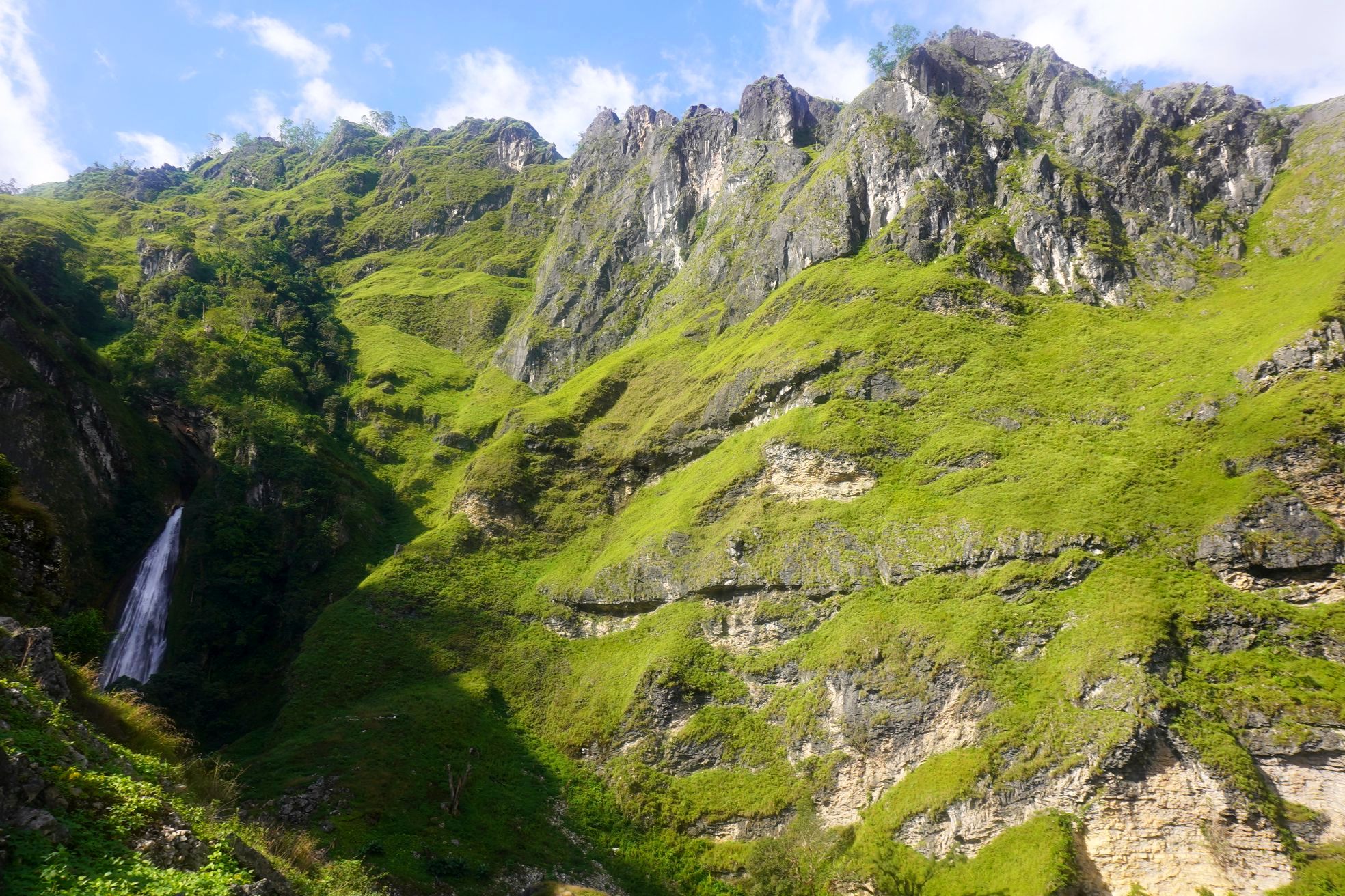
A small waterfall was a taster for the much larger Dokomali Falls in the distance which we were heading toward.


Ahead was Mt Kablaki, a far more difficult and dangerous mountain to climb than Mt Ramelau / Tatamailau, which looked about right in this weather.

Dokomali Falls are in a spectacular setting, with anticipation building as you approach.

An enterprising local has built a bamboo bridge to access the waterfall, for which payment is required to cross ($1.50 for Timorese and $2 for malae / foreigners).


The falls didn’t disappoint up close.

After getting plenty of photos we descended down to Lepulau on the main road, to spend a second night camping on the veranda of a school.


For the detailed route and logistical information please select this hike below (click top left for the list of hikes).


Leave a Reply